Hi Everyone,
Here’s the Weather Hazard Forecast for Camden County, NJ SKYWARN for Thursday, March 13th.
| 5 Day Weather Hazard Forecast | |
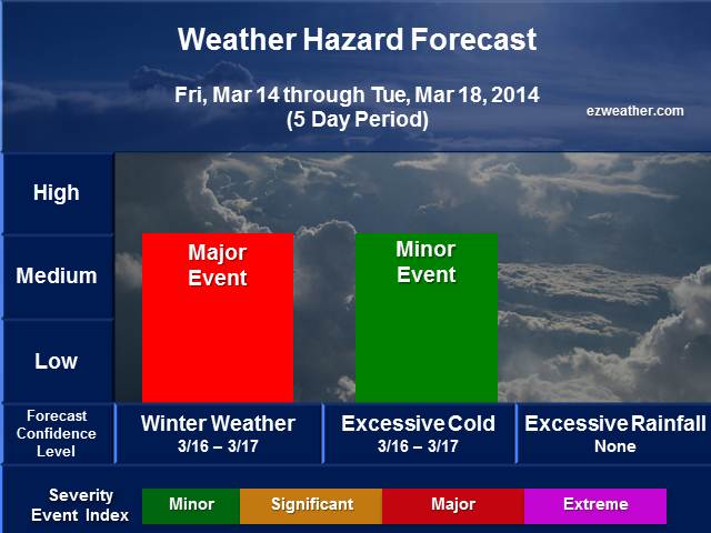 |
Quick insight into this new winter weather threat. The model data appears to be increasing toward a new winter weather threat for Sunday into Monday. A strong storm will be taking shape over the deep south over the weekend. This system will likely bring severe weather over the weekend in the Deep South. This system will likely tap into the Gulf of Mexico and the Atlantic, which means it will carry a lot of precipitation. At the same time and has been the case, the arctic air intrusions we’ve seen will likely continue this month. This has been the case this winter. There is still a lot of arctic air up in Canada that can be tapped at any time and once again, high pressure will build down from Canada on Sunday. As this high builds down, this will bring the arctic air down and at the same time this storm system will be tracking in our direction, but to the south and then near the Middle Atlantic Coast on Monday. There is some question as to where the track of the storm will take place. For now, this situation is very fluid and definitely bears watching. For now, highly recommend members of EOC, RACES and SKYWARN pay very close attention to this event. It has the potential to being major winter weather event, which could mean major interruption to the county.
|
6 to 15 Weather Hazard Forecast |
|
 |
 |
 |
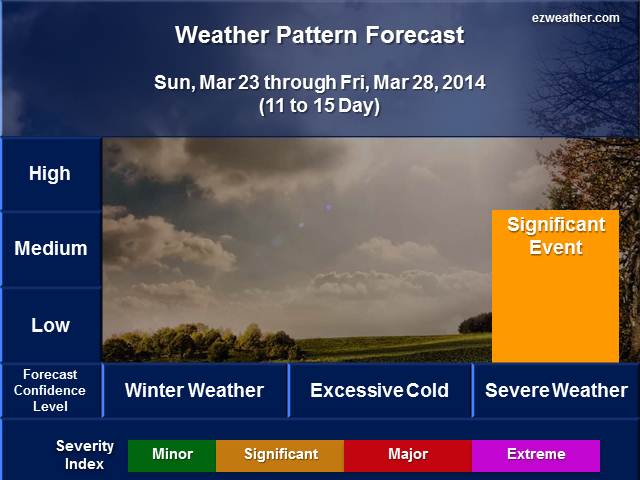 |
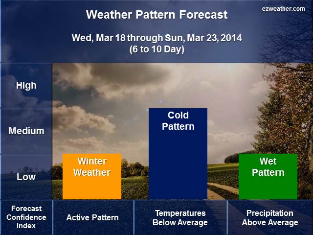
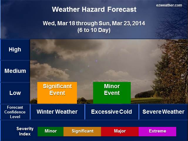
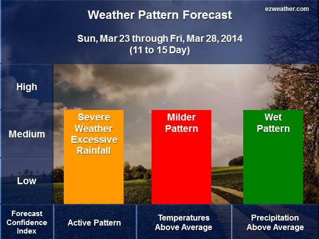
Quick note about the long range period. The 6 to 10 Day period still could be one where winter weather threat is still possible. The upper air looks to favor arctic air intrusions and at the same time, the risk of another storm system to track in a favorable direction to bring more winter weather. Even though we’re in March, there is a lot of arctic air in Canada that can be tapped at any time. Pretty much stating what we are seeing in the 5 day period. As we get into the 8 to 15 day period, then the things change to a milder and yes, severe weather and excessive rainfall becomes the primary threats. The upper air pattern favors the storm track going back toward our west. This means that we would be on the right side of these systems and that means severe weather is possible and with any snow cover we get from the short range, we could get flooding. No doubt, March will continue to provide our county with wild swings.
|
National Weather Service Mount Holly, NJ |
|
| Check out the Climate Prediction Center’s U.S Hazard Outlook by clicking here |
|
| Storm Prediction Center | |
| NWS Mount Holly NJ Facebook | |
| NWS Mount Holly, NJ Twitter |
************************************************************************************************************************************************
Background
I am very excited to provide a new forecast product for Camden County, New Jersey. In here will be a new experimental product that I’ve produced for the Philadelphia Area. Right now, I like to issue this product once a week, especially on Sundays. If time permits, I’ll issue a new forecast during the week. This forecast will aide Emergency Management, SKYWARN, and RACES for Camden County. The idea is to provide everyone with a forecast that gives them the needed lead time to prepare for hazardous weather that could impact the county.
As you check out the tables below, be sure to refer to the several slides below to gain a full understanding on Forecast Confidence and Severity Index.

