Hi Everyone,
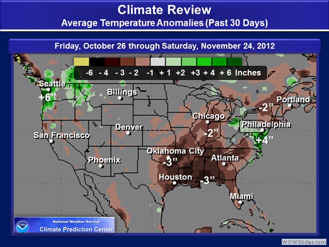
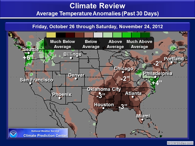
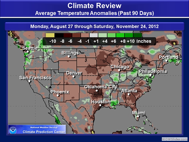
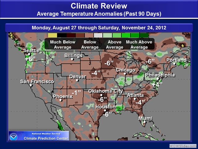
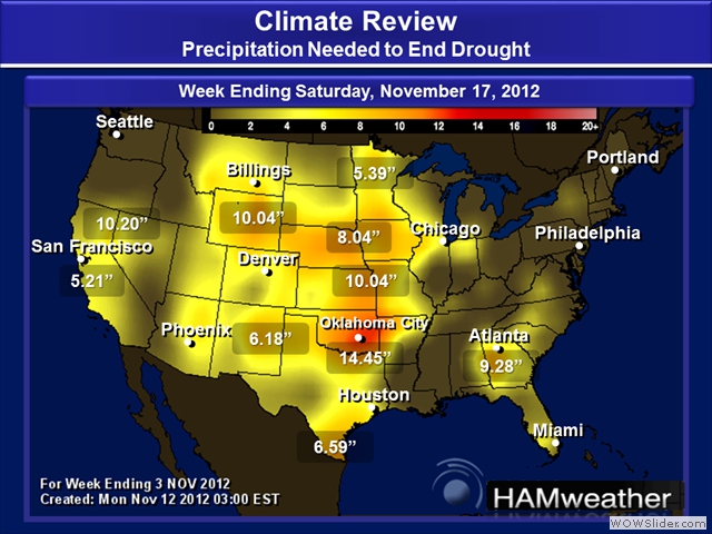
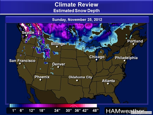
Here’s another addition of Weather Trends for Wednesday, November 28th. Check out the images below on the Upper Air Pattern, Temperatures and Precipitation. We are definitely seeing some interesting trends, especially some clues to how the 2012 – 2013 Winter Season may shape up.
Part 1 – Weather Trends: Upper Air
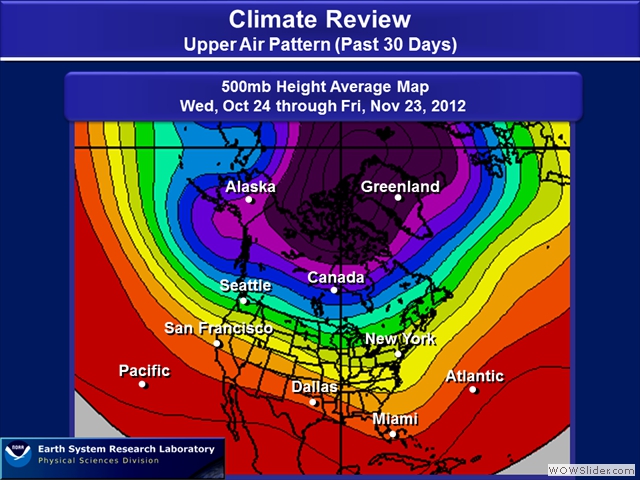
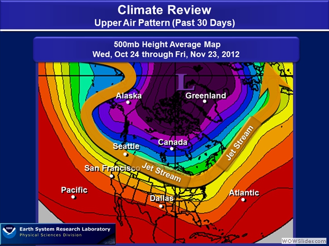
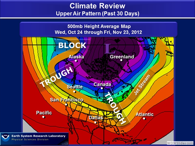
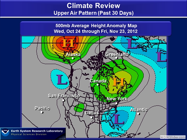
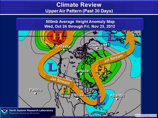
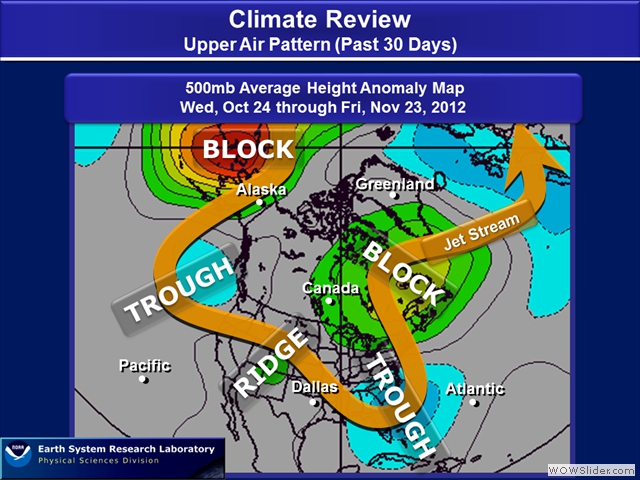
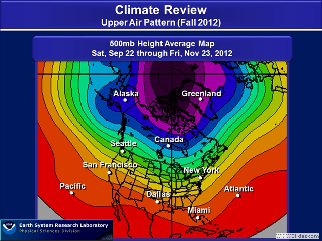
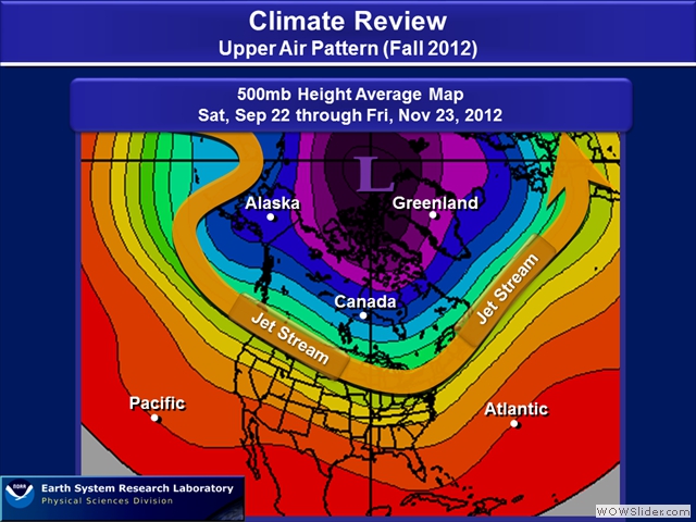
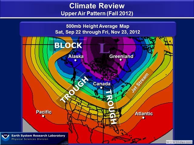
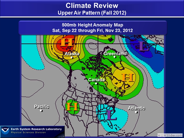
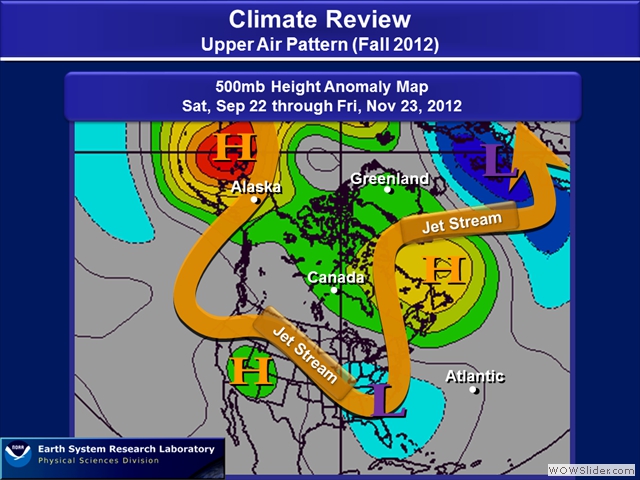
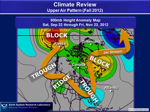
Background Information: In this section, we’ll be reviewing the Upper Air Pattern. In using 500mb maps, they provide a big picture view of what happening upstairs in the atmosphere. The average 500mb plot allowed me to draw the jet stream, which typically can be found on the 300mb or 250mb map. Here we can roughly see ridges and troughs. When I mention ridges, think of the high pressure at the surface (i.e., height lines in the shape of a dome or point up), while troughs are low pressure at the surface (i.e., you see the height lines curved like a shape of a bowl or dip). Troughs are typically associated with stormy weather, while ridges are the opposite, drier and stable. The 500mb anomaly maps is comparing the current analyses to climatology. So, the way to think of anomaly maps, its more of a signal such as where ridges and troughs are developing stronger compared to climatology. For these maps, we’ll look at the past 30 days to how the Fall Pattern has developed.
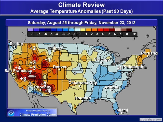
Part 2 – Weather Trends: Temperatures
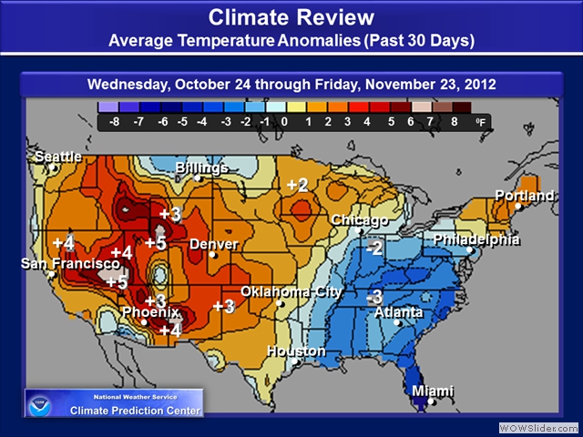
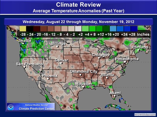
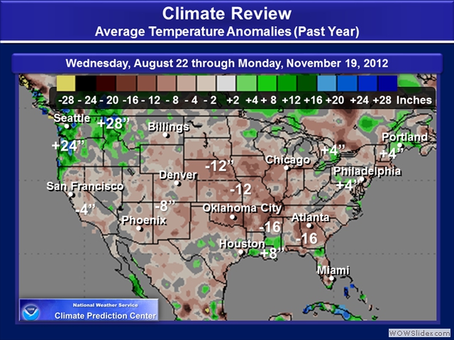
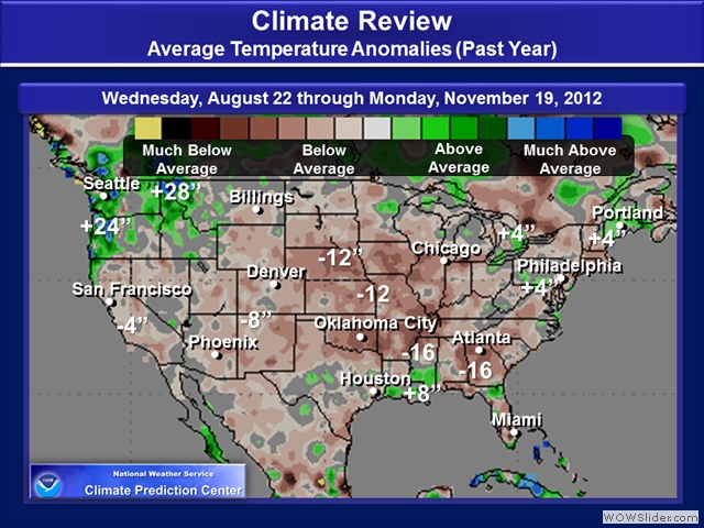
Background Information:In this section, we’ll be reviewing how temperatures are compared to climatology. Basically, you can see how much below or above average temperatures have been over a period of time such as 30 to 90 Days ago.
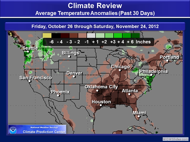
Part 3 – Weather Trends: Precipitation Totals
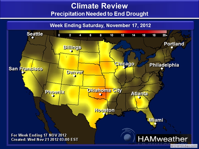
Background Information: The section here will show you how precipitation has been comparing to climatology. Basically, you can see how much or below average precipitation has been over a period of time such as a few months to a year.

