
Hi Everyone,
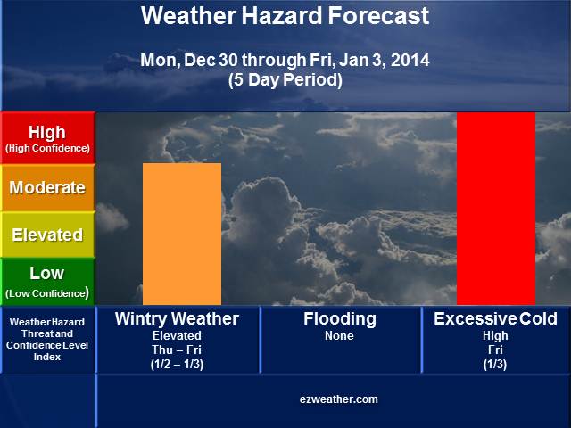
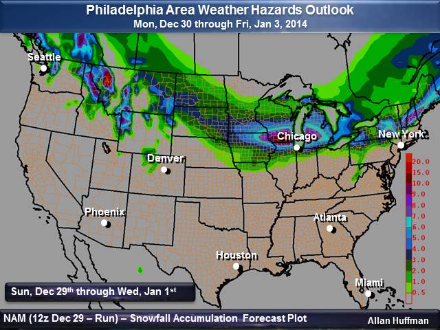
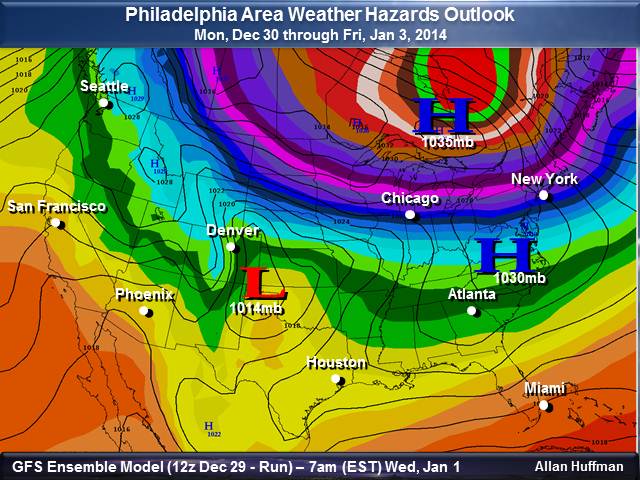
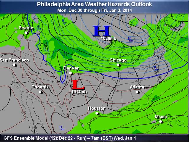
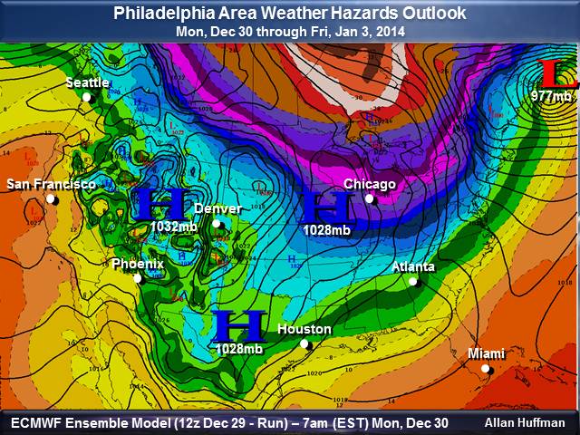
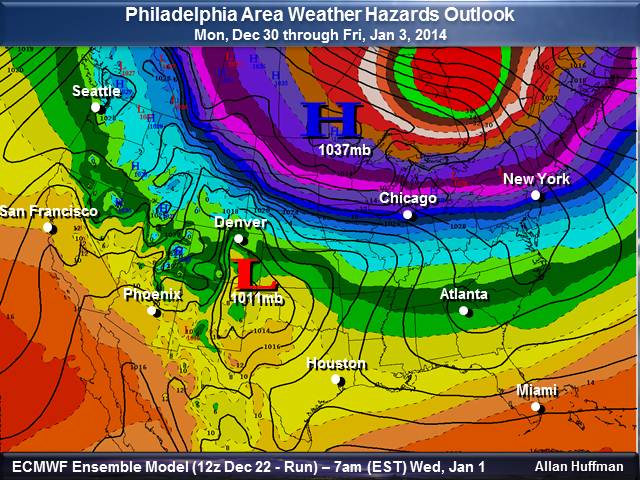
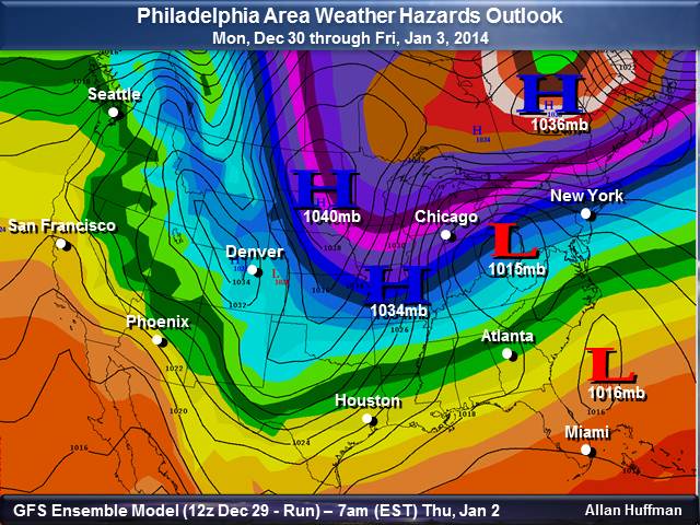
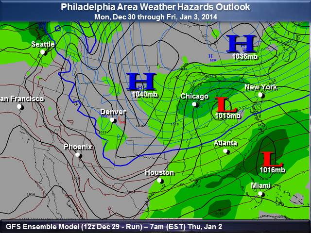
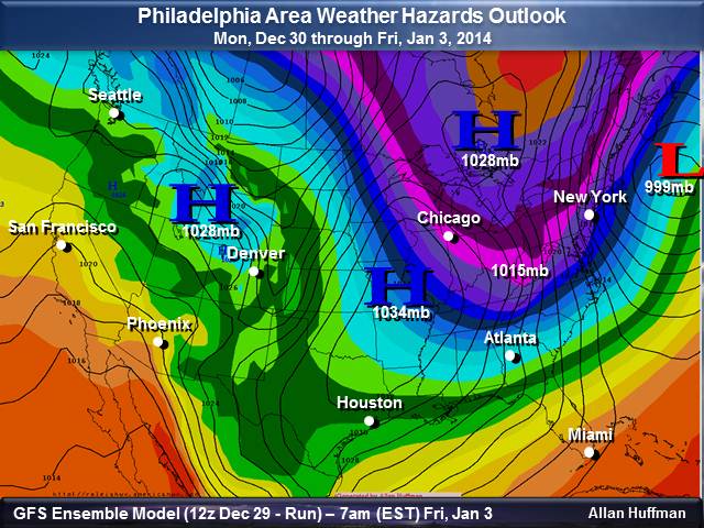
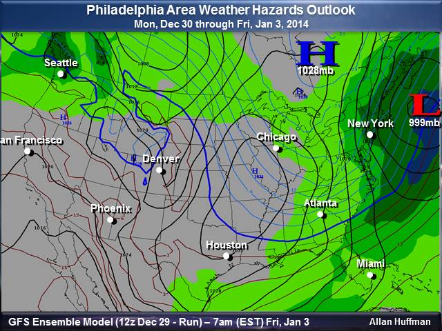
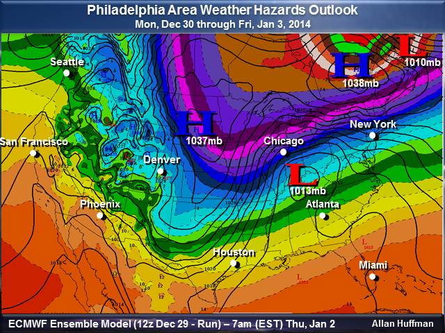
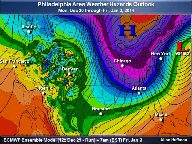
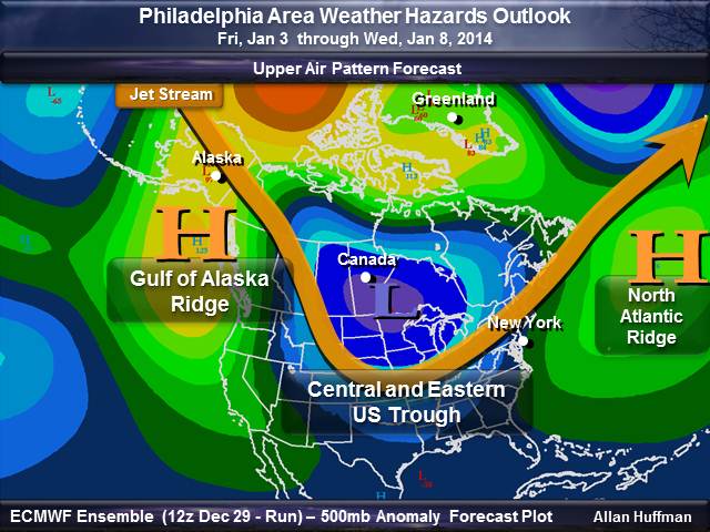
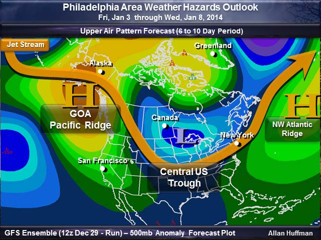
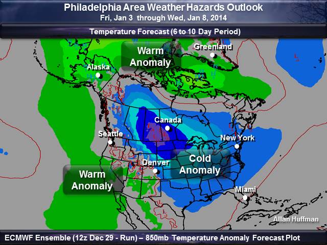
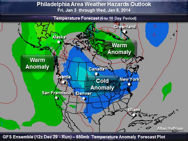
I’m finally able to publish my outlooks this afternoon. Usually, I publish them on Sunday. Anyway, I made a few changes just a few minutes ago on my outlooks. Potential is building for a significant winter storm by the end of the week for much of the Philadelphia Area. Low pressure will gather over the Deep South on Wednesday and Thursday and then move off the Middle Atlantic Coast and intensify. Quite a bit of the model data, which backed off the idea of of a big winter storm have come back. I will have updates on this developing situation as the week goes on. So, a big snow threat is possible late this week, then some record cold is expected this weekend. As this storm system rapidly intensifies and moves away from the coast, bitter arctic air will move in for the weekend. If we get a fresh snow cover, temperatures could dip into the single digit range. So, wintry weather is definitely going to be the big story late this week. Definitely stay alert for late this week and if you have travel plans, please plan accordingly.
After check out these outlooks, check your local National Weather Service forecasts by clicking here. Just enter your zip code and you’ll be able to get the latest updates.
ezweather.com’s Weather Hazard Forecasts
|
||||||||||||||||||||||||||||||||||||||||||||||||||||||||||||||||||||||||||||||||||||||||||
|
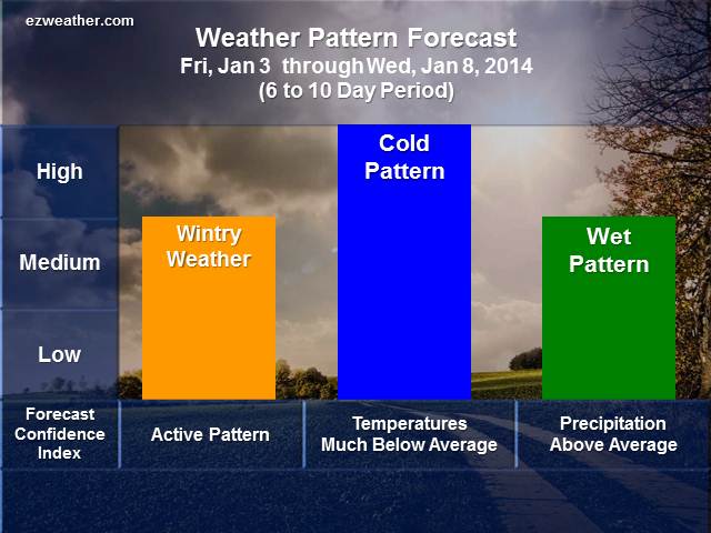
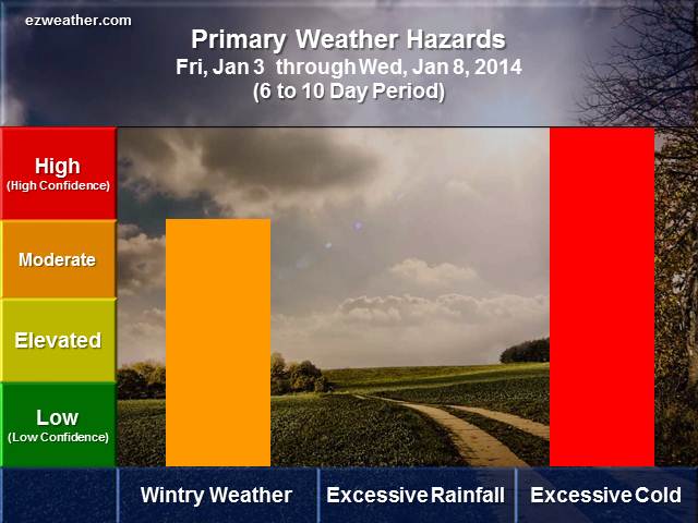
W 6 to 10 Day Weather Outlook
|
||||||||||||||||||||||||||||||||||||||||||||||||||||||||||||||||||||||||||||||||||||||||||
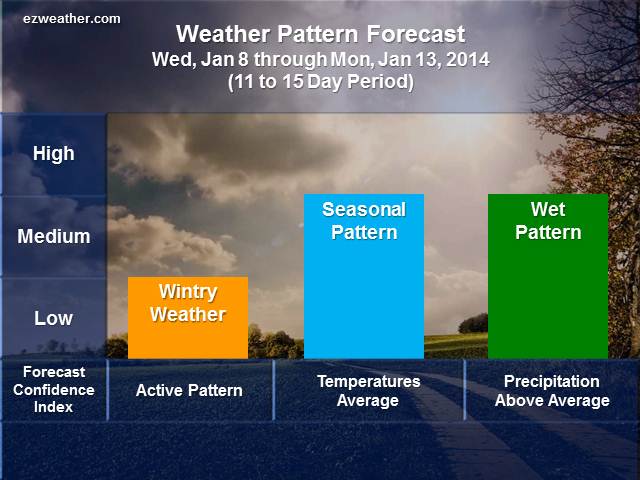
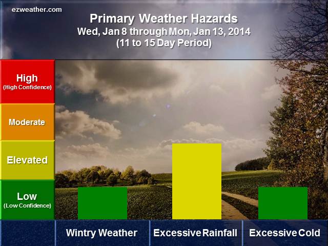
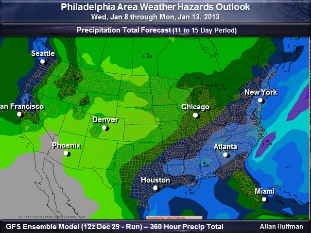
11 to 15 Day Weather Outlook
 |
 |
| Check out the supporting data for my forecasts. You can get an idea of how I assess this period for hazardous weather. | |
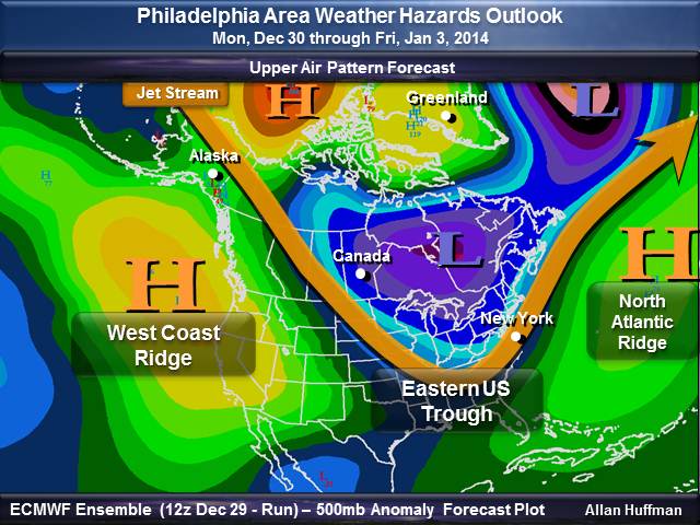
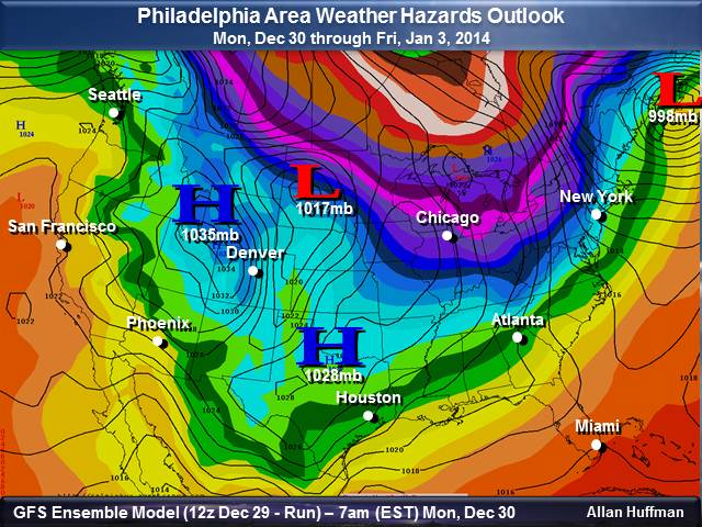
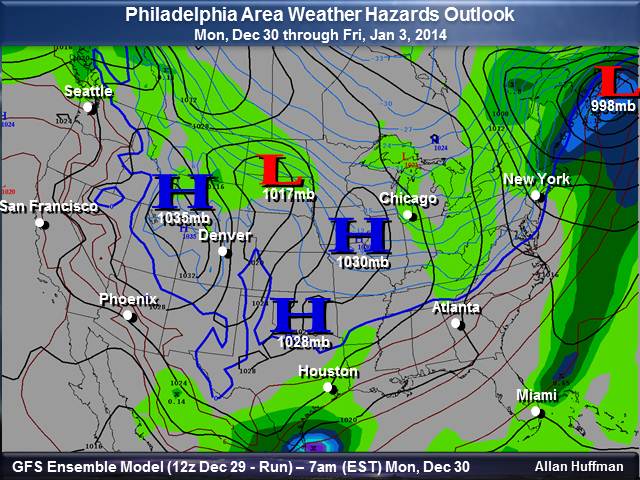
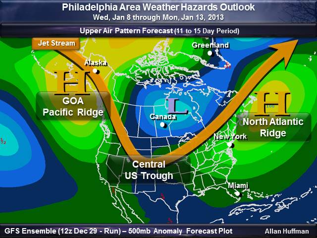
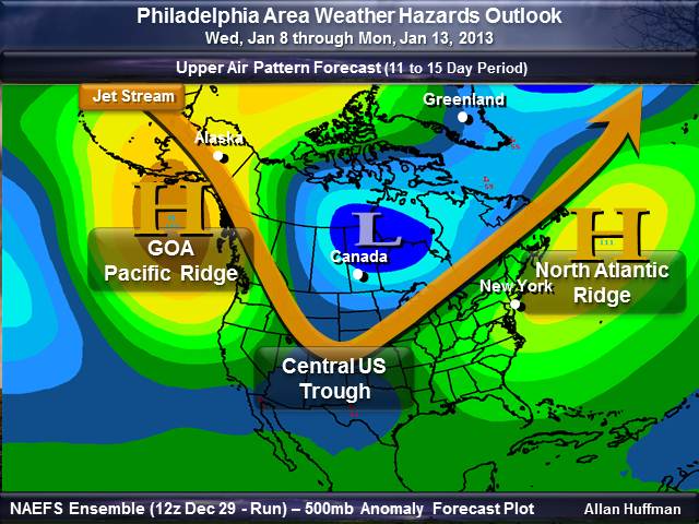
| Upper Air Pattern | |
 |
 |
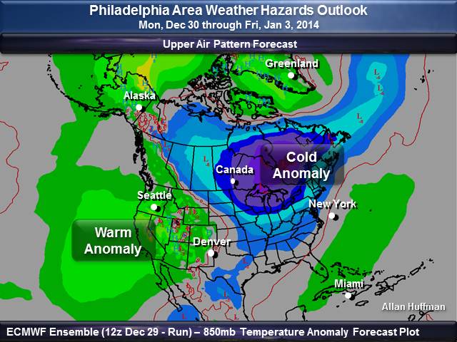
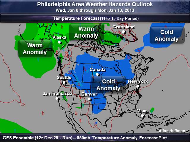
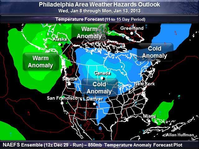
| Temperature Outlook | |
 |
 |
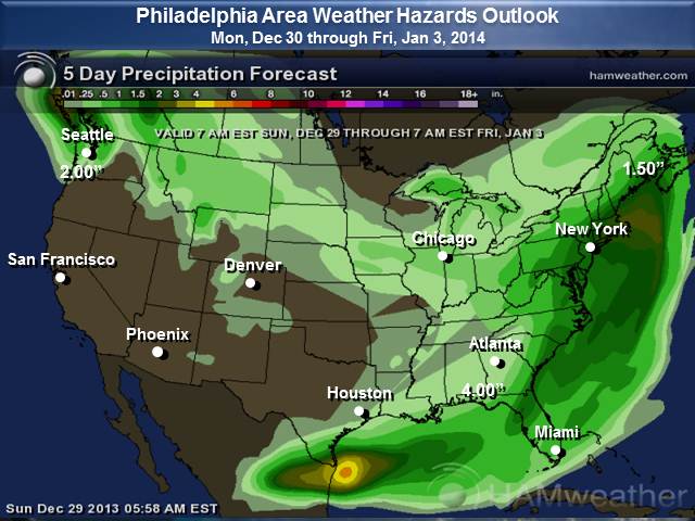
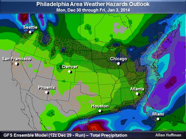
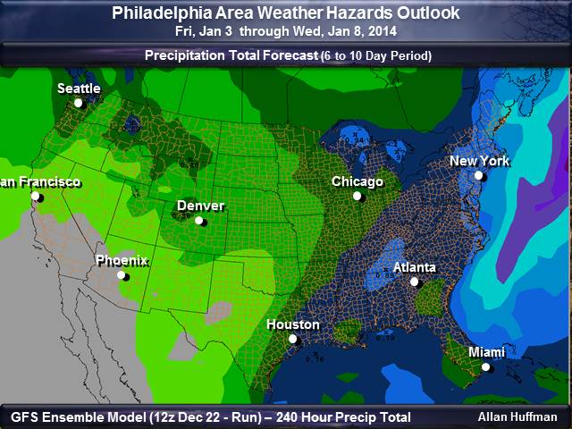
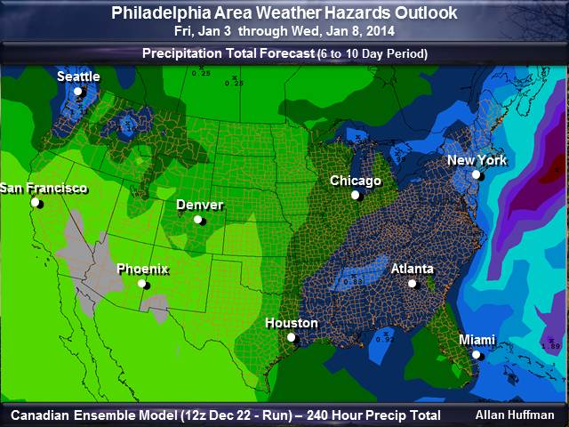
| Precipitation Total Outlook | |
 |
 |
********************************************************************************************************************************************** Background Information This type of forecast is high level and designed to help folks to plan for hazardous weather with a longer lead time. So, these type of forecasts will aid anyone involved with Skywarn, Emergency Management and the Public. These forecasts are quick assessments and experimental. The goal with this type of forecast is to to point out whether each period will be active or not. In addition, these tables can be treated as a severe weather index level. W