
Hi Everyone,
Certainly has been a busy one for me as I get ready for the holidays. I still wanted to get this forecast package out tonight. So, here’s a quick assessment of where we are heading with the weather and hazards we could be facing over the next two weeks.
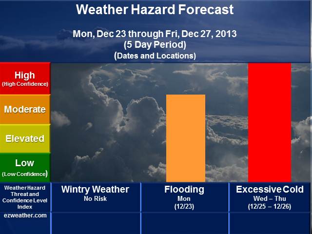
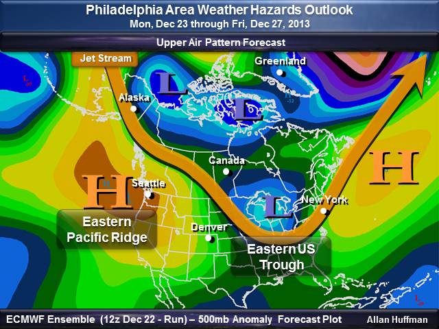
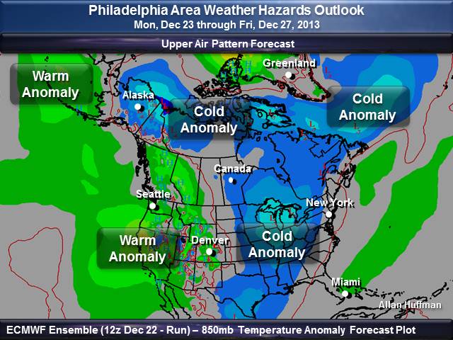
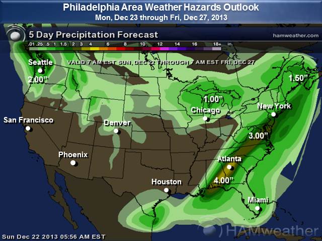
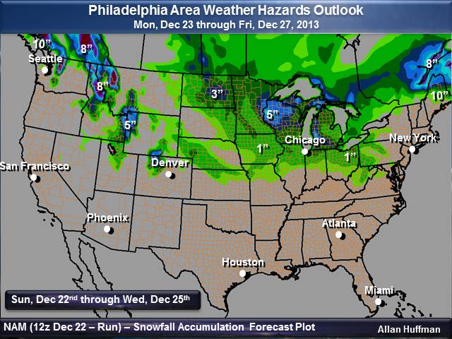
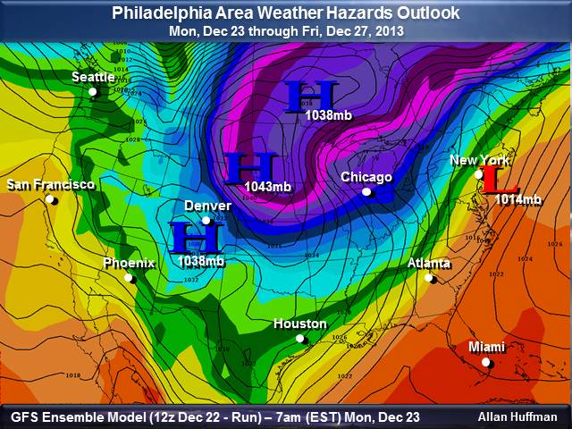
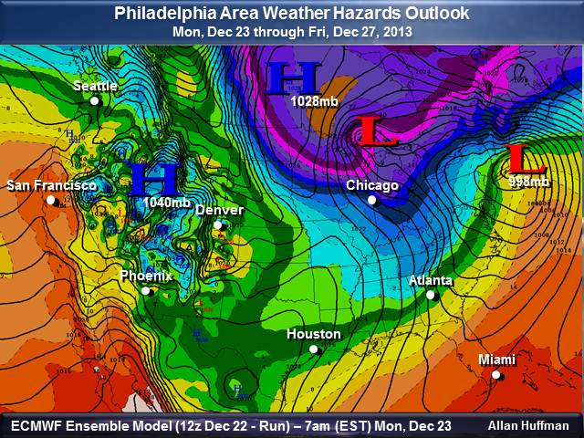
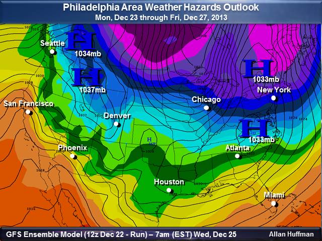
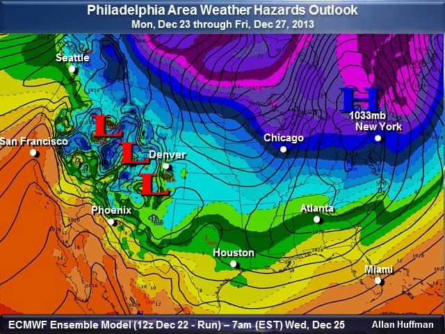
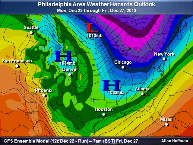
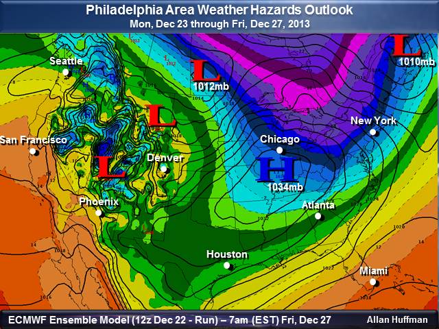
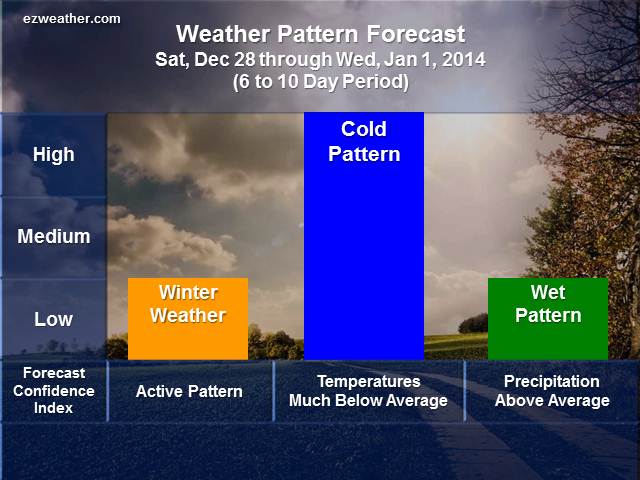
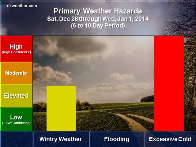
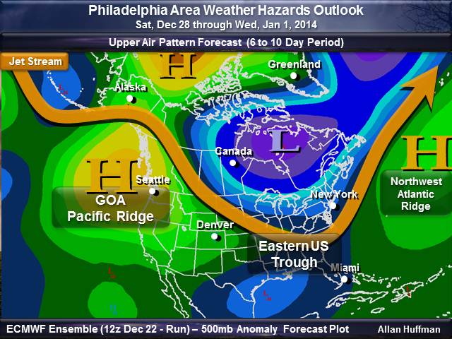
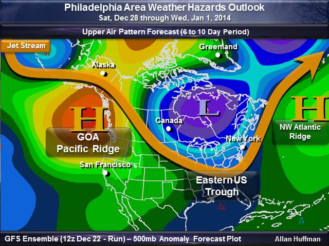
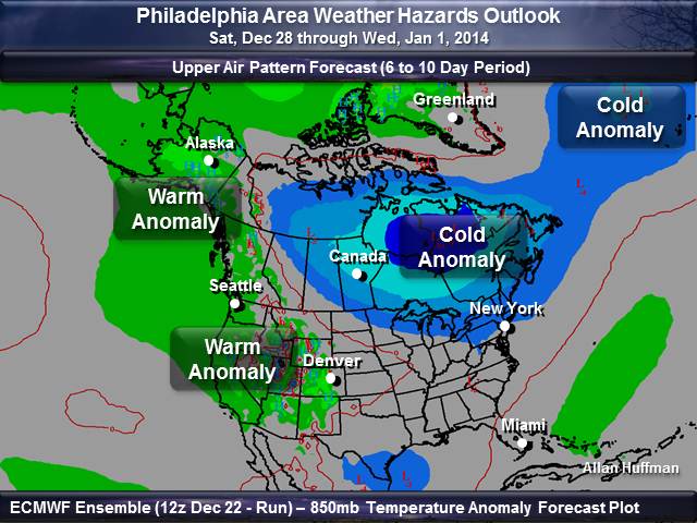
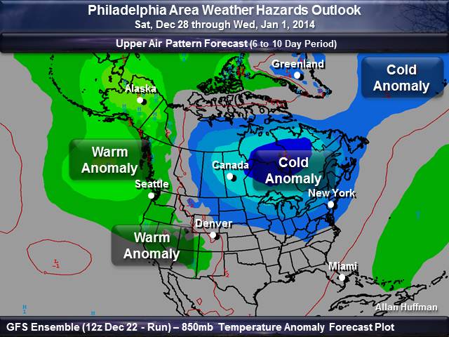
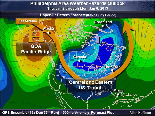
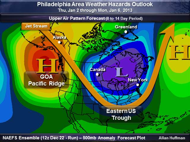
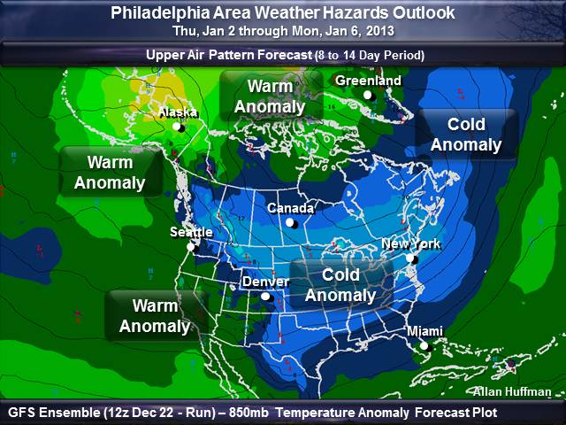
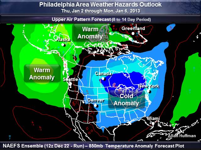
The biggest theme to this forecast will be going from the record breaking warmth that the Philadelphia Area has experienced will now be going back to winter type weather. Before we get there, a risk of flooding is possible on Monday. A cold front will put an end to all this unseasonably mild weather on Monday. National Weather Service is forecasting 1 to 2 inches of rainfall on Monday. So, there is a threat for some flooding across portions of the area. Once we get passed Monday, then colder weather is on the way. The jet stream will again be developing a trough that will allow arctic air come down from Canada. Now as I get a bit more technical on what will be driving our future weather pattern.. One of the keys to how the December has been on the cold side and even wintry weather has been how the Pacific has been setup. There has been a consistent upper level ridging over the north and eastern Pacific and up to Alaska. This type of ridging has forced the jet stream to dig a trough over here in the East. Even though the Arctic Oscillation (AO) has been primarily positive. Plus, the North Atlantic Oscillation (NAO) has been positive. Right now the Pacific is really winning the battle. Latest Climate Prediction Center’s telleconnection indice forecasts are showing the AO and NAO heading toward negative as we head into January. So, the bigger theme with this forecast package will be the return of winter like weather pattern.
After check out these outlooks, check your local National Weather Service forecasts by clicking here. Just enter your zip code and you’ll be able to get the latest updates.
| ezweather.com’s Weather Hazard Forecasts Southeastern Pennsylvania, Northeast Maryland, South Jersey, and Delaware Issued: Sunday Evening, December 22nd
|
||||||||||||||||||||||||||||||||||||||||
|
W
6 to 10 Day Weather Outlook
|
||||||||||||||||||||||||||||||||||||||||
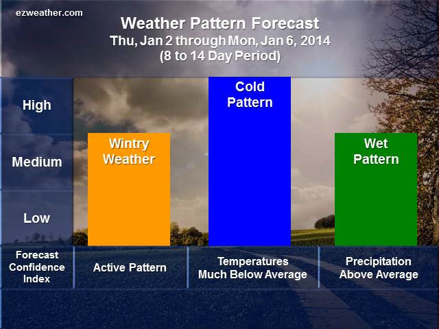
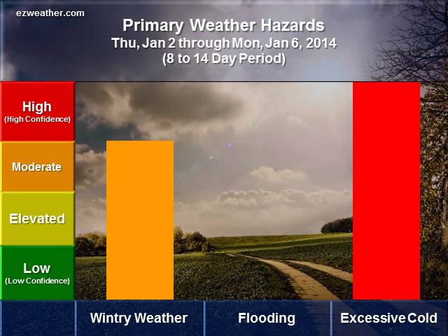
8 to 14 Day Weather Outlook
 |
 |
| Check out the supporting data for my forecasts. You can get an idea of how I assess this period for hazardous weather. |
|
| Upper Air Pattern | |
 |
 |
 |
 |
**********************************************************************************************************************************************
Background Information
This type of forecast is high level and designed to help folks to plan for hazardous weather with a longer lead time. So, these type of forecasts will aid anyone involved with Skywarn, Emergency Management and the Public. These forecasts are quick assessments and experimental. The goal with this type of forecast is to to point out whether each period will be active or not. In addition, these tables can be treated as a severe weather index level.
W