
Good Morning Everyone,
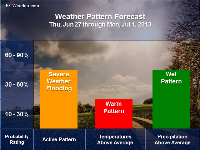
Last night I recorded several videos on the Philadelphia Area Weather Hazard Outlook for the next 6 to 10 Days. This type of outlooks is more high level and its a high level look at what kind of pattern we may be facing during this period. So, we’ll be taking a loot at the potential patter, which focus on the position of the jet stream and then what kind of hazardous weather we may face in this period.
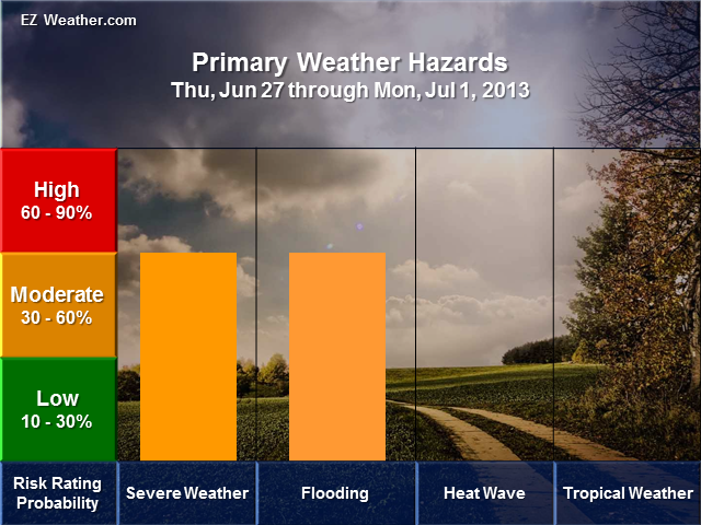
The idea on forecasting weather hazards is to determine the probability or chance of it happening and potential of the event. This specialized forecast is focused on providing folks involved with Skywarn, Emergency Management and Public in planning for significant weather ahead of time.
EZ Weather.com
Philadelphia Area – 6 to 10 Day Weather Hazard Outlook
Issued Saturday, June 22nd at 5:00 PM EDT
Zone Legend Reference (Click on the Zone Name to View Map)
Disclaimer Information
- This is an experimental product.
- The goal of this product is to aid Skywarn, Emergency Management, and Public Officials with extended lead time to prepare for Significant Hazardous Weather.
Please refer to official outlooks and forecasts issued by the National Weather Service, Weather Prediction Center, Storm Prediction Center and the National Hurricane Center.
X
X
Forecast Videos
X
Weather Discussion Videos
X
Weather Safety Websites
FEMA
NOAAWatch
Office of Climate, Water, and Weather Services
NWS Pamphlets