
Hi Everyone,
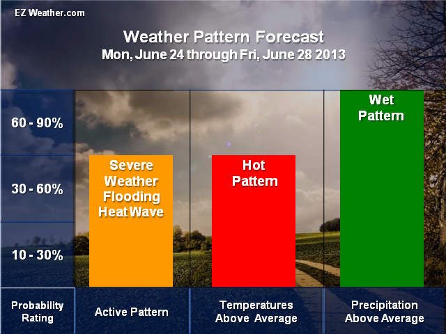
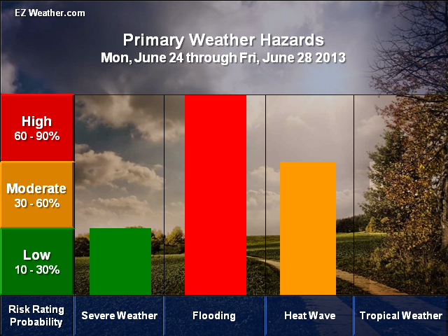
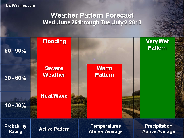
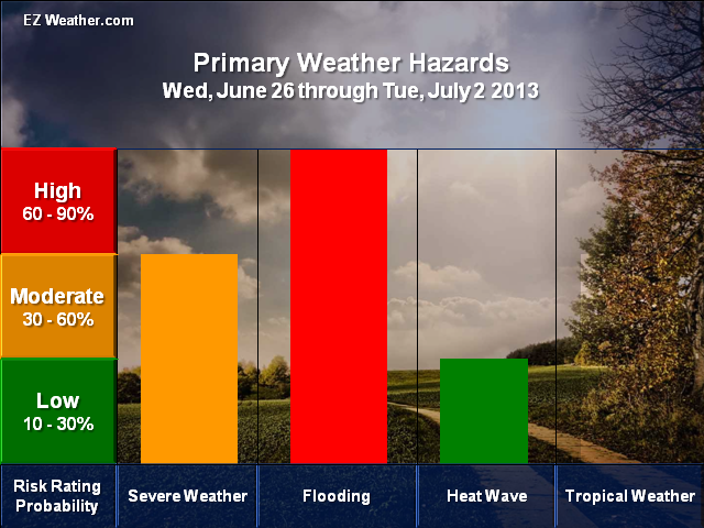
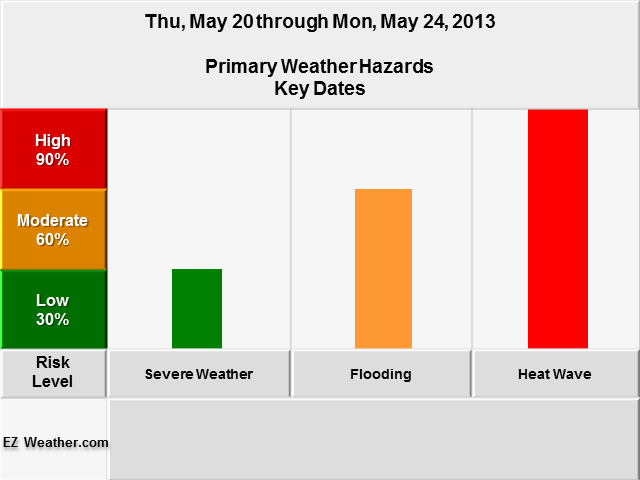
Check out what will happen the next 6 to 14 days. According to the Climate Prediction Center’s new outlooks for the next 6 to 14 days, our weather pattern will continue to be very active with the potential for our second heat wave, more precipitation, which means the risk of flooding and even severe weather. Initially, we will see a building ridge in the East this weekend and into next week. This will allow some of that heat from the Western and Central US to finally make its our way. But the Jet Stream, will buckle again and bring back very unsettled weather again, meaning more heavy rainfall and severe weather. I think everyone would like to see this very wet pattern ease some, but doesn’t appear so at this time.
Check out the outlooks I put together. The idea here is to give you a sense of how active the pattern will be and potential weather hazards for these time period. Also, the temperature and precipitation outlooks are based on the Climate Prediction Center’s outlooks.
|
EZ Weather.com Philadelphia Area 6 to 14 Day Weather Hazard Outlook |
| Issued Wednesday, June 19th at 9:30 AM EDT |
| 6 to 10 Day Outlook |
  |
| 8 to 14 Day Outlook |
  |
Disclaimer Information
|
| In Depth View |
| Click here to Access U.S Weather Hazard Outlook |