|
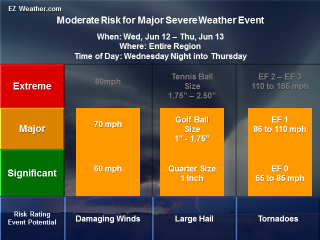
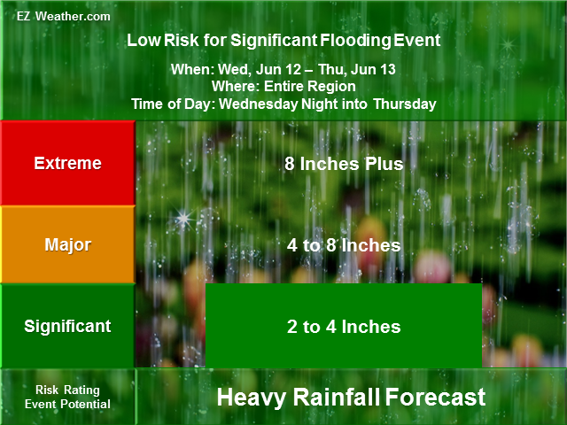
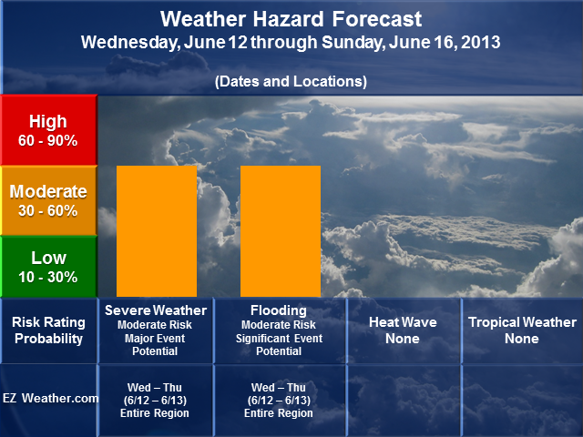
A Good Late Evening Everyone, Certainly been a few active days with the remnants of Andrea bringing plenty of heavy rain this past weekend and then a warm front brought heavy rain and some severe weather to portions of the Philadelphia area. Even a few tornado reports were over Maryland and Delaware. Now our attention turns to late Wednesday into Thursday. Evidently, we have a pretty potent low pressure system that will be moving in from the Ohio Valley Wednesday. Already the Storm Prediction Center has place most of Illinois, Indiana, and western Ohio under a moderate risk for severe weather on Wednesday. This means widespread damaging winds over 70mph and large hail of 1 inch or greater. As we approach Wednesday night into early Thursday, this system will intensify as it heads in our direction. At this time, the potential does exist for damaging winds, large hail and even few tornadoes. Right now, the key to the forecast and whether this event will verify is the placement of the low pressure system and and its warm front and cold front. If our region is east of the intensifying low with a warm front to the north and a cold front to the west, then we have a higher risk for a widespread severe weather event. This means we could be facing winds of 60 to 70mph, hail of up to golf size and even several tornadoes. Bottom line, this situation has the potential to be a major one. Stay tune for updates tomorrow, especially from the Storm Prediction Center and the National Weather Service, Mount Holly, NJ.
EZ Weather.com Philadelphia Area 5 Day Weather Hazard Outlook |
| Issued Tuesday Evening, June 10th at 11:50 PM EDT |
| X |
| Weather Hazard Forecast |
 |
| Zone Legend Reference (Click on the Zone Name to View Map)
|
| X |
|
Weather Hazard Forecast Details
Zone Legend Reference (Click on the Zone Name to View Map)
Disclaimer Information
|
| Latest Updates |