
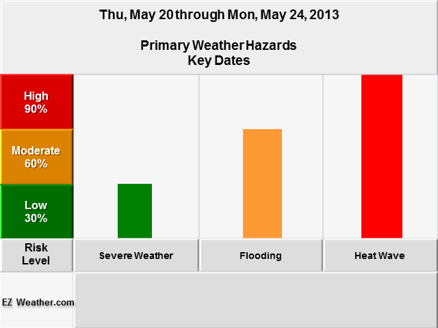
Hi Everyone,
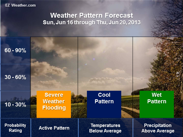
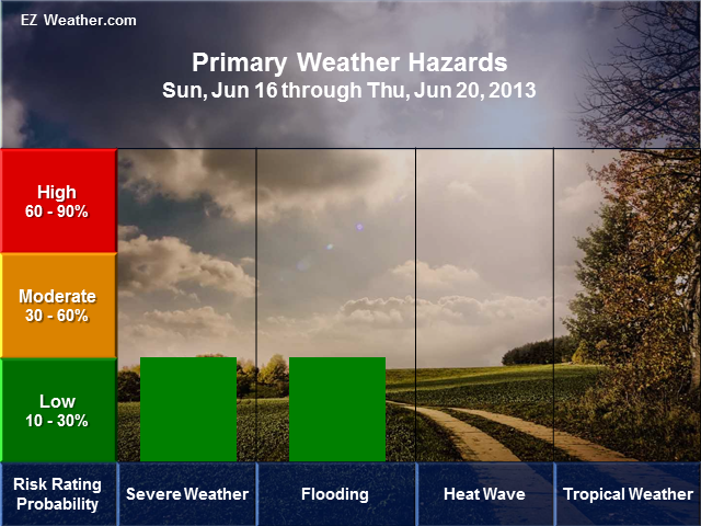
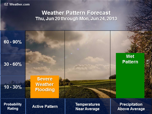
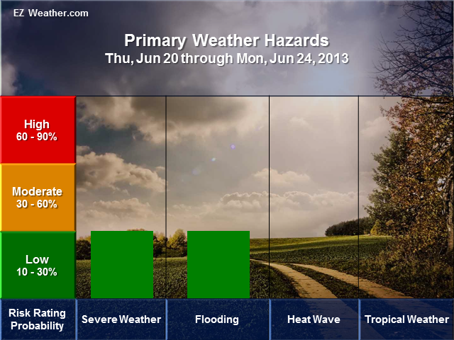
Check out what will happen the next 6 to 14 days. Looks like our weather pattern may remain active with the potential for severe weather and flooding. Temperatures look to be below average in the beginning of this outlook, but will get back to near average high and low temperatures. For precipitation outlooks, looks like we’ll continue to be wetter than average. Since we’ve been getting a lot of rainfall, any additional rainfall will add to the risk of flooding. Certainly wouldn’t take much to flood areas with any additional heavy rain. So, its definitely something to keep an eye on.
|
EZ Weather.com Philadelphia Area 6 to 14 Day Weather Hazard Outlook |
| Issued Monday, June 10th at 11:56 PM EDT |
| 6 to 14 Day Outlook |
  |
| 8 to 14 Day Outlook |
  |
Disclaimer Information
|
| In Depth View |
| Click here to Access U.S Weather Hazard Outlook |