|
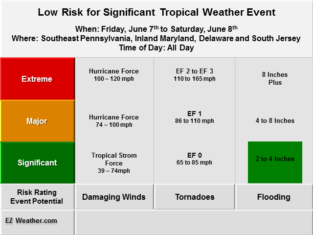
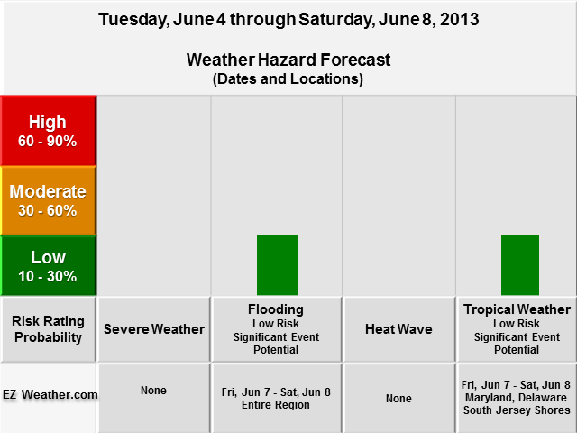
Good Evening Everyone, Another round of updates to my Weather Hazard Outlook tables. The first one below is an overview of risk probability of basic weather hazards such as severe weather or flooding. The next two tables get into the specific forecasts. Whats different this time around is that they deal with how bad will a certain weather hazard event be. I think this adds a more meaning to this type of forecast. The forecast later this week is pretty interesting. For the Tropical Weather category hazard is borderline, because there will be a system that may start out as tropical in the Gulf of Mexico, but may end up transitioning into a significant coastal storm that will bring heavy rain and strong gusty winds along the coast. Definitely something to watch by week’s end. Overall, my goal here is to provide specialized forecast that will help anyone thats involved with Skywarn, Emergency Management and the Public. Definitely check back as I’ll be providing more updates on the site. EZ Weather.com Philadelphia Area 5 Day Weather Hazard Outlook |
||||||||||
| Issued Monday Evening, June 3rd at 11:00 PM EDT | ||||||||||
| X | ||||||||||
| Weather Hazard Forecast | ||||||||||
 |
||||||||||
| Zone Legend Reference (Click on the Zone Name to View Map)
|
||||||||||
| X | ||||||||||
|
Weather Hazard Forecast Details
Disclaimer Information
|
||||||||||
| Latest Updates | ||||||||||