
Good Evening Everyone,
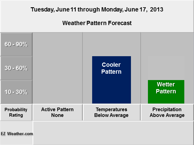
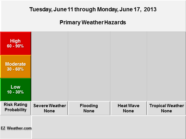
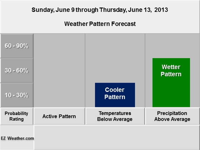
The final long range outlook here is the 8 to 14 Day Outlook. This one will be focused on the next 8 to 14 Days. What you see below are two tables. The first one is a combination of what I’m seeing with on whether we’ll have an active period such as severe weather or perhaps a heatwave. For the temperature and precipitation, those are from the Climate Prediction Center. The second table deals with risk probability. You’ll notice the primary weather hazards such as severe weather or heat wave. Essentially, its basically saying, what are the chances for a certain weather hazard. For the longer range, the forecast is a high level view of the pattern and whether it may yield something more significant.
Finally, at the bottom, I provided a link that will take you to another blog that I update, which features the US Hazards Assessment. This one is from the Climate Prediction Center. You’ll notice that I’ve developed my outlooks very similar to their blocks of time they look at. Also, I put together a section in this blog where you can check out all the maps that deal the forecast over the next 6 to 14 days. The images auto update. So, If you want to look at a more in depth look, definitely check it out.
|
EZ Weather.com Philadelphia Area 8 to 14 Day Weather Hazard Outlook |
| Issued Monday Evening, June 3rd at 11:30 PM EDT |
 |
| Zone Legend Reference (Click on the Zone Name to View Map)
Disclaimer Information
|
| W |
| Weather Hazard Forecast Details |
 |
| In Depth View |
| Click here to Access Climate Prediction Center’s 8 to 14 Section |