
Hi Everyone,
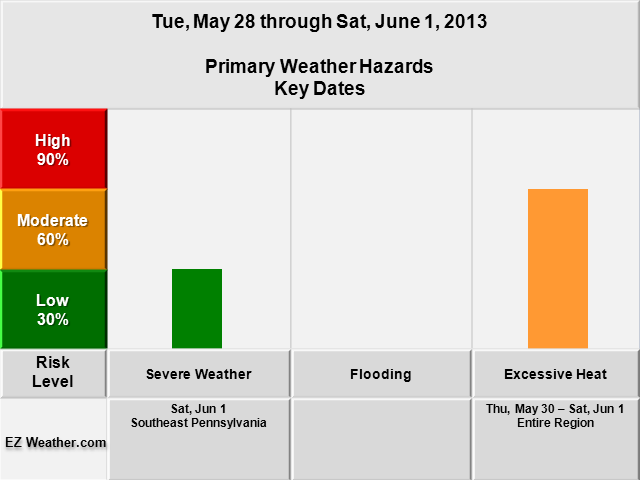
Very excited to bring you my Weather Hazard Risk forecasts. First time in a while, I can finally produce some forecast blogs. These forecasts will be issued for the Philadelphia area, which includes Southeast Pennsylvania, South Jersey, Northeastern Maryland, and Delaware. Definitely check out the maps I put together below. So, back to how these risk forecast are put together.. I take into account what the National Service is reporting and what the model data is showing. The overall goal here is to get folks attention on significant weather and plan accordingly. Hopefully, this will help folks who are involved with Skywarn, Emergency Management and other services. One of the really good folks out there, who is Dr. Steve Lyons had a great presentation on hurricanes and showed a similar table to the one below I have. I really think it helps convey the message on how big of a risk we may see say for severe weather or excessive heat over a course of a week or next two weeks. In addition, on Sundays and hopefully in a few weeks, I’ll be providing webcast shows of the same type of outlooks like this one and the next 6 to 14 days.
|
EZ Weather.com Philadelphia Area 5 Day Weather Hazard Outlook |
| Issued Tuesday, May 28th at 12:45 PM EDT |
 |
| Zone Legend Reference (Click on the Zone Name to View Map)
Disclaimer Information
|
| Weather Hazard Forecast Details |
Excessive Heat
|
Severe Weather
|
| Latest Updates |