Hi Everyone,
In this blog, I want to share with you a Climate Review on Weather Trends. On Weather Trends, I’ll be sharing with three main sections, Upper Air, Temperatures, and Precipitation Totals. Its always important to see how the weather has been trending. This information is a vital toward weather forecasting. So, let’s begin…
Part 1 – Weather Trends: Upper Air
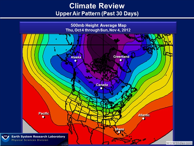
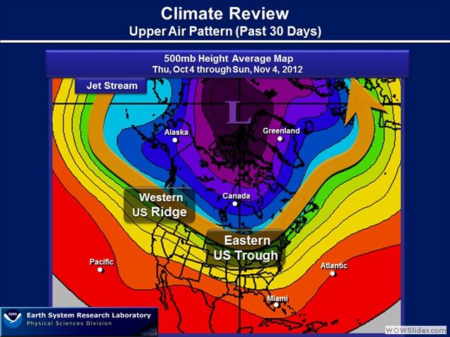
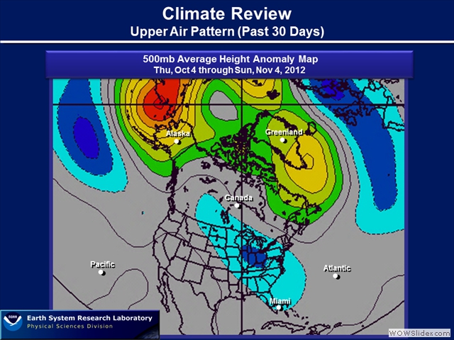
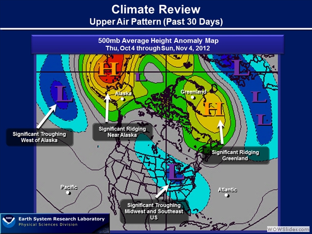
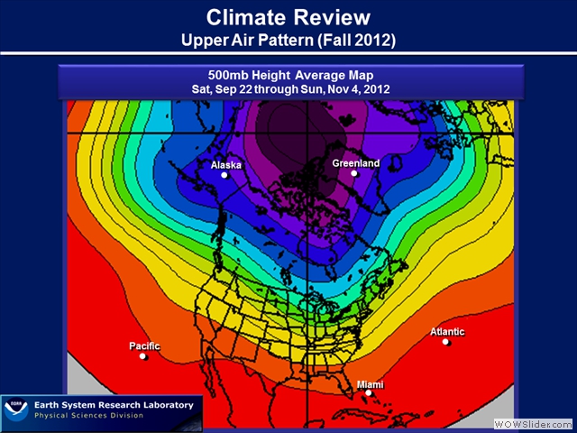
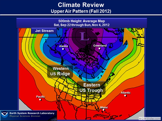
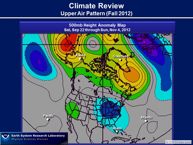
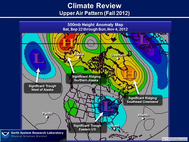
In this section, we’ll be reviewing the Upper Air Pattern. In using 500mb maps, they provide a big picture view of what happening upstairs in the atmosphere. The average 500mb plot allowed me to draw up the jet stream, which typically can be found on the 300mb or 250mb map. Here we can roughly see ridges and troughs. When I mention ridges, think of the height lines increasing, while troughs you see the height lines dip. Trough are typically associated with stormy weather, while ridges are the opposte, drier and stable. The 500mb anomaly maps really show a signal, a tendency or another way to think of it, where ridges and troughs are developing stronger compared to climatology. For these maps, we’ll look at the past 30 days to how the Fall Pattern has developed.
Part 2 – Weather Trends: Temperatures Trends
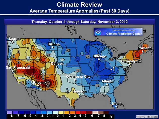
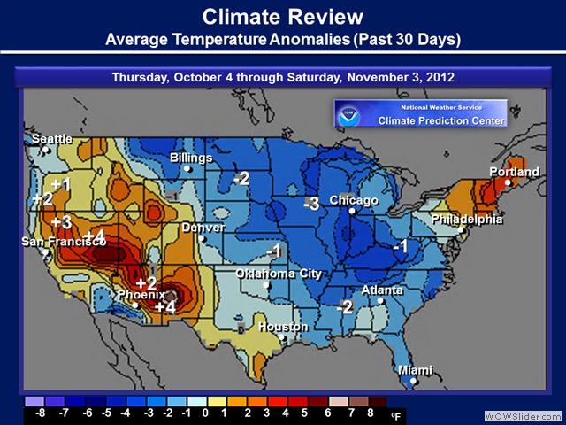
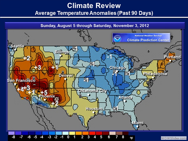
In this section, we’re reviewing how temperatures are compared to climatology. Check out the the past 30 Day and 90 Day temperature trends.
Part 3 – Weather Trends: Precipitation Trends
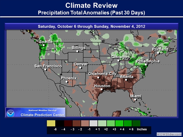
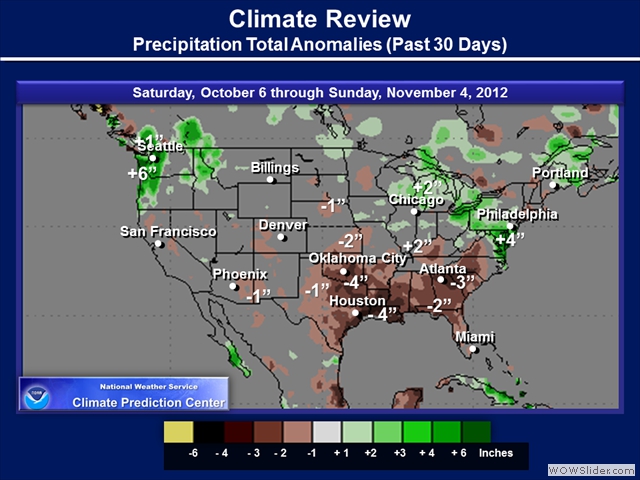
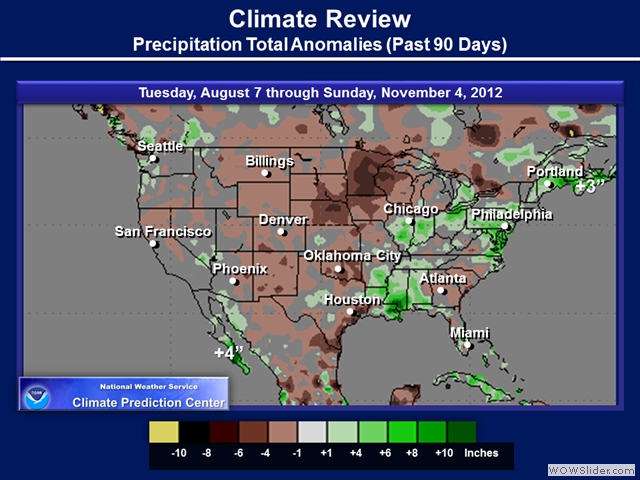
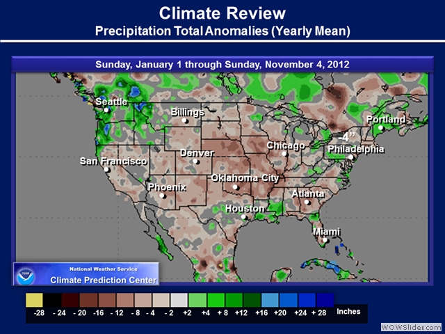
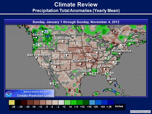
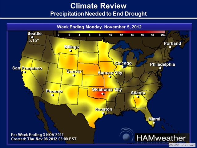
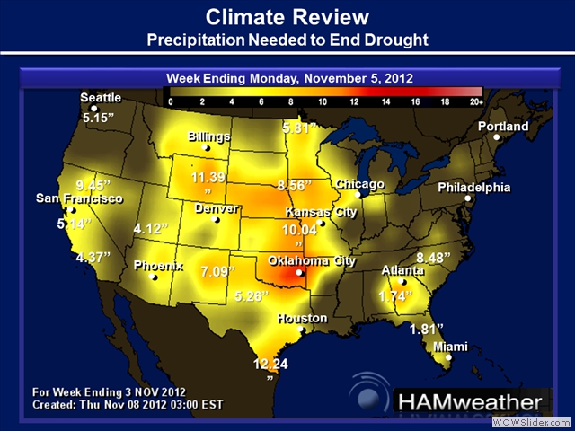
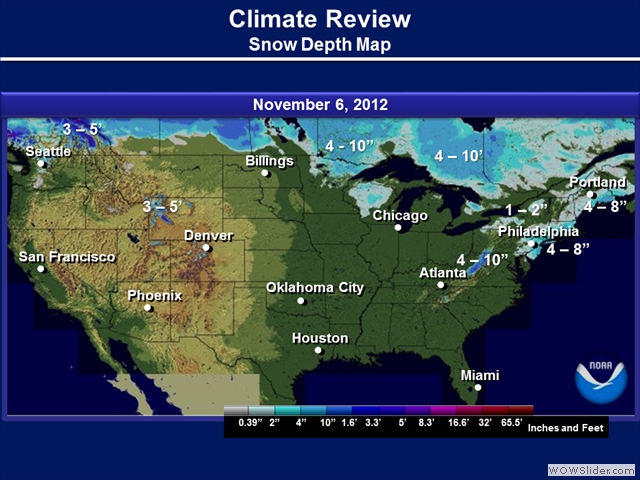
The final section here will show you how precipitation has been trending the past couple of the months to a year.

