
Good Evening Everyone,
A wild week is in store for the county and be an active one. We have two threats to contend with this week. A flood threat for Wednesday and then a major winter weather event for Wednesday night into Thursday. Then a cold blast again Thursday into Friday again. Check out the details below. I’ll keep everyone updated on these threats with new updates.
Beyond this week, the weather pattern still will favor below average temperatures.
Click on the number, which corresponds to the PowerPoint slide number.
Weather Threat Assessment Forecast
Monday, March 2nd through Monday, March 16th
Issued: Sunday Evening, March 1st
.
Forecast |
Period Forecast |
Period Forecast |
||||
| Weather Threats | Weather Pattern | Weather Threats | Weather Pattern | Weather Threats | ||
| 1 | 2 | 3 | 4 | 5 | ||
Note: Number indicates PowerPoint slide number
As always with this experimental forecast product, due check back in the NWS official forecasts and official outlooks on any future weather threats that could impact our county.
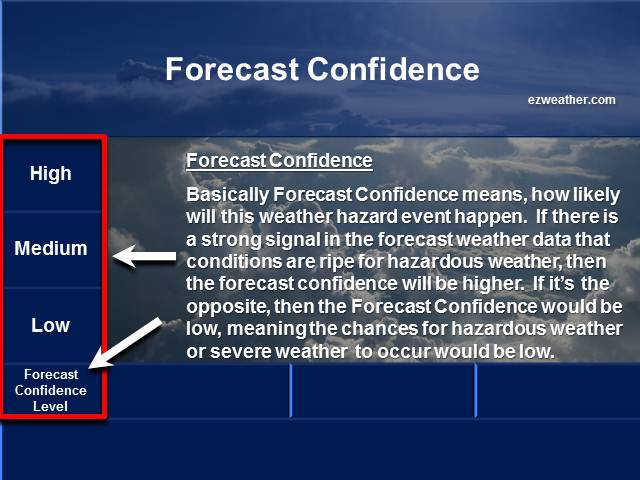
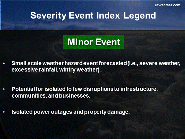
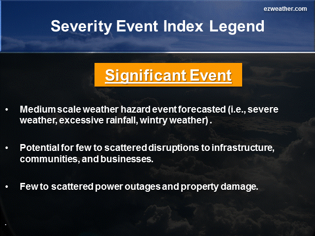
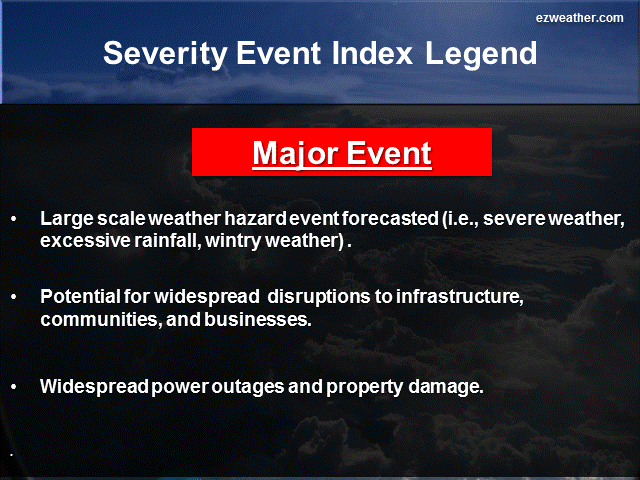
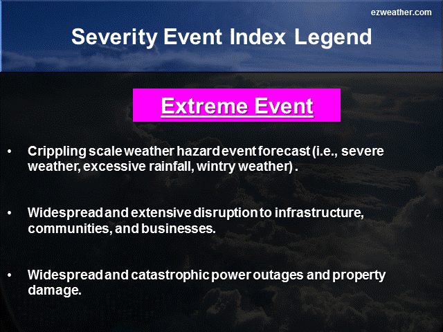
Below are thumbnails that further describe what Forecast Confidence and Severity Index are
Forecaster Confidence
Severity Index
My brief thoughts for each period….
5 Day Period (Monday, March 2nd through Friday, March 6th)
During this period, we have two things to be concerned with. On Tuesday, low pressure thats moving from the Western US will track toward up to the Great Lakes. As this low tracks in that direction, moisture will move into the area Tuesday afternoon, starting out as a mix of snow and sleet. The snow and sleet will begin to change to some freezing rain, but will change over to all rain after midnight. The rain may be heavy at times overnight into Wednesday. So, for the first part we have a wintry threat for late Tuesday into the evening, then a potential flood threat on Wednesday. Temperatures on Wednesday will peak into the 50s, but then crash Wednesday night. Now, things get really interesting Wednesday night into Thursday.
As this cold front crosses the county on Wednesday night, it will then stall to the south and east, probably just offshore near the Middle Atlantic coast. One of the reasons for the front will to stall is high pressure centered to the east of the front. This may act as a wall and keep the front nearby. The critical part of this forecast is the placement of the front. If the front is nearby, we’ll have waves of low pressure track along it. Hence, heavy precipitation will be over our area. The upper level dynamics and moisture setup looks very impressive, so a threat of a major snowfall is possible Wednesday night into Thursday. Snow would end Thursday evening. Right now, model some of the model guidance is indicating major snowfall of at least 6 inches or more. 12z Euro run today came in with 6 to 8 inches and the latest 18z GFS shows 8 inch plus. The idea here is they are showing heavy snow possible, but more importantly the idea of a front stalling and an overrunning setting up over our area. Now other model guidance has the front stalling to the south. So, we have to wait and see on how this event unfolds.
Anyway, definitely a situation to keep a close eye on. For now, my forecast confidence is medium on it being major a major event.
Finally, almost forget to add this in. Yet another arctic blast Thursday night into Friday again. What a week this will be with weather changes. Good grief..
6 to 10 Day Period (Saturday, March 7th through Wednesday, March 11th)
For this period, its looking to be a colder than average period temperature wise. We may have to watch several clipper systems that may dive down. Confidence is low, but its something to keep an eye on.
11 to 15 Day Period (Thursday, March 12th through Monday, March 16th)
For this period, we may see a moderation in temperatures, but may be facing a stormy period again, potentially favoring more winter weather. Here’s a quick view of our telleconnection indices
– AO (Arctic Oscillation): Forecast to return back toward neutral
– NAO (North Atlantic Oscillation): Forecast to head toward negative
– PNA (Pacific North American Pattern): Forecast to head back to positive.
What this all means is a ridge developing along the west coast (PNA), polar vortex may come back south in Canada (AO), and ridge developing over Greenland (NAO). This may favor more winter weather for this period. Temperatures would likely be below average and precipitation be above average.
Now, checking the ensembles, they do show moderation and perhaps a milder period. Perhaps, a pattern change. For now, I think its a period to watch for additional winter weather. Forecast confidence for more winter weather is low. I did indicate major winter weather event, based on the indices above, but at this time, low confidence. We definitely have time, so more changes to follow.
X
|
National Weather Service Mount Holly, NJ |
|
| Check out the Climate Prediction Center’s U.S Hazard Outlook by clicking here |
|
| Storm Prediction Center | |
| NWS Mount Holly NJ Facebook | |
| NWS Mount Holly, NJ Twitter |
************************************************************************************************************************************************
Background
- I am very excited to provide a new forecast product for Camden County, New Jersey. In here will be a new experimental product that I’ve produced for the Philadelphia Area.
- Right now, I like to issue this product once a week, especially on Sundays. If time permits, I’ll issue a new forecast during the week.
- This forecast will aide Emergency Management, SKYWARN, and RACES for Camden County. The idea is to provide everyone with a forecast that gives them the needed lead time to prepare for hazardous weather that could impact the county and to help with their planning.