
Good Evening Everyone,
After several months, I’m finally getting back to forecasting again. So, let’s see how the next 2 weeks may play out. We do have another week some pretty cold weather to deal with. Then we have to keep an eye on coastal storm threat toward the end of the week into the weekend. So, we may have to contend with another round of wintry weather. As we get beyond next weekend, the weather pattern looks to moderate some and even feel milder. Still, looks like the longer range will be on the wet side.
Click on the number, which corresponds to the PowerPoint slide number.
Weather Threat Assessment Forecast
Monday, February 23rd through Monday, March 9th
Issued: Sunday Evening, February 22nd
.
Forecast |
Period Forecast |
Period Forecast |
||||
| Weather Threats | Weather Pattern | Weather Threats | Weather Pattern | Weather Threats | ||
| 1 | 2 | 3 | 4 | 5 | ||
Note: Number indicates PowerPoint slide number
As always with this experimental forecast product, due check back in the NWS official forecasts and official outlooks on any future weather threats that could impact our county.
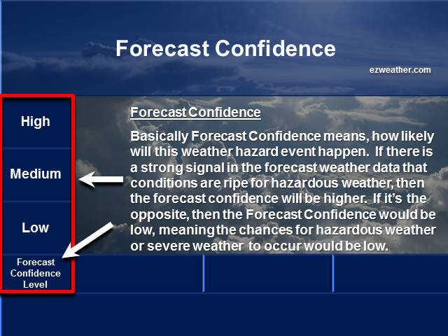
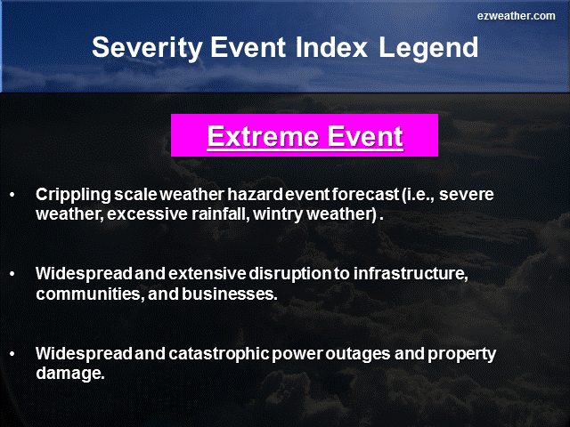
Below are thumbnails that further describe what Forecast Confidence and Severity Index are
Forecaster Confidence
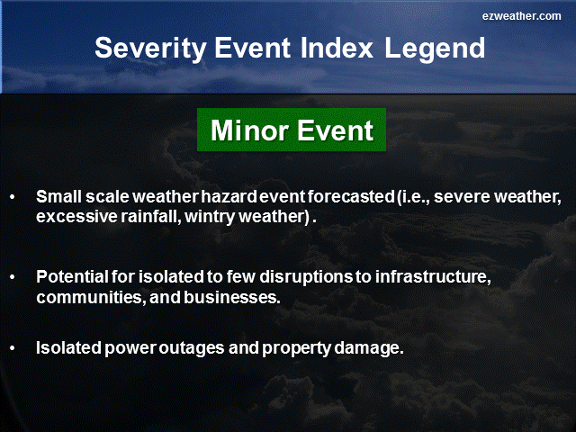
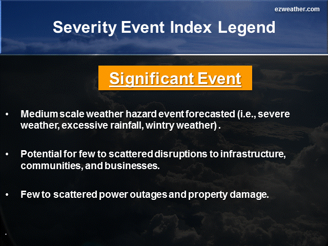
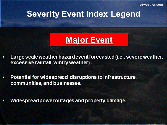
Severity Index
My brief thoughts for each period….
5 Day Period (Monday, February 23rd through Friday, February 27th)
This period we can expect another round of arctic air to impact the area this week. For this week, I’m highlighting to be a major cold event. NWS is forecasting the coldest nights to be Tuesday morning with lows down to 2. That looks to be the coldest day of the week, but we get hit again with another round of some very cold weather Thursday into Friday with highs only in the 20s and overnight lows down to around 10. So, another week of some excessive cold.
The other threat I’m highlighting in my outlook this week is potential of another winter weather event between the 25th and 28th. My confidence level on this threat is low, but its definitely a watch item and one to keep an eye on this week. We may literally close this month out with a bang with a major winter storm. The GFS model has hinted at a coastal storm developing later this week, but takes it out to sea. Originally, this model showed a significant coastal storm impacting the area with heavy snow, but the model hasn’t taken this threat more offshore. The European model, does show a coastal low developing along the Southeast US coast on Wednesday, but takes it out to sea. The one thing we’ve seen this winter is that the models tend to trend things to the north, so, its possible that we may see this occur again later this week.
6 to 10 Day Period (Saturday, February 28th through Wednesday, March 4th)
For this period, the persistent cold weather we’ve been experiencing will finally ease up. The upper pattern favors a trough developing over the Western US and some ridging in the East. While, we expect temperatures to moderate to near average levels, precipitation will be above average. I did note that the threat of heavy rainfall is possible. So, with any frontal passages, we may get some heavy rainfall, that could cause some flooding. Confidence level is the in the medium level.
11 to 15 Day Period (Thursday, March 5th through Monday, March 9th)
For this period, we can expect the moderation to continue. The upper air pattern favors a trough over the Western US and a ridge in the Eastern US. Temperatures are forecasted to be above average and precipitation to be above average. So, this period looks to be similar to the 6 to 10 day. The threat exist for some excessive rainfall, which could lead to flooding. As mentioned above, any front passages may lead to excessive rainfall.
X
|
National Weather Service Mount Holly, NJ |
|
| Check out the Climate Prediction Center’s U.S Hazard Outlook by clicking here |
|
| Storm Prediction Center | |
| NWS Mount Holly NJ Facebook | |
| NWS Mount Holly, NJ Twitter |
************************************************************************************************************************************************
Background
- I am very excited to provide a new forecast product for Camden County, New Jersey. In here will be a new experimental product that I’ve produced for the Philadelphia Area.
- Right now, I like to issue this product once a week, especially on Sundays. If time permits, I’ll issue a new forecast during the week.
- This forecast will aide Emergency Management, SKYWARN, and RACES for Camden County. The idea is to provide everyone with a forecast that gives them the needed lead time to prepare for hazardous weather that could impact the county and to help with their planning.