
Good Evening Everyone,
Finally back to issues a new Weather Threat Assessment for Camden County this evening. Check out my discussion below for what I’m thinking for this time range. Looks like summer will make a return this week with highs reach near 90 Tuesday through Thursday. Then for Labor Day weekend, the heat returns again. For any severe weather and flooding those threats appear low at this time. Finally, Tropical Storm Cristobal doesn’t appear it will impact the county, so this is great news.
As always with this experimental forecast product, due check back in the NWS official forecasts and outlooks on any future weather threats that could impact the county.
New table format below. Just click on the number, which corresponds to the PowerPoint slide number.
Weather Threat Assessment Forecast
Monday, August 25th through Monday, September 8th
Issued: Sunday Evening, August 24th
.
Forecast |
Period Forecast |
Period Forecast |
||||
| Weather Threats | Weather Pattern | Weather Threats | Weather Pattern | Weather Threats | ||
| 1 | 2 | 3 | 4 | 5 | ||
Note: Number indicates PowerPoint slide number
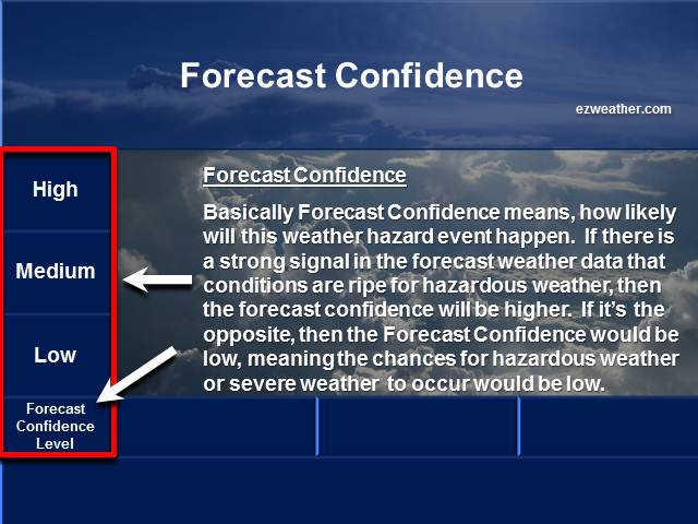
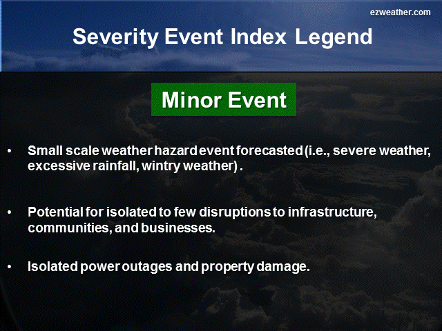
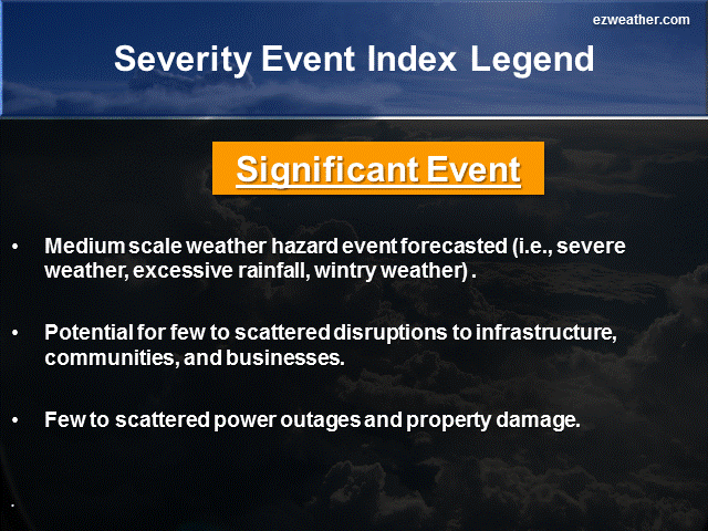
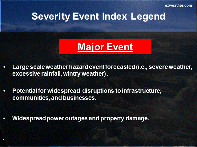
Below are thumbnails that further describe what Forecast Confidence and Severity Index are
Forecaster Confidence
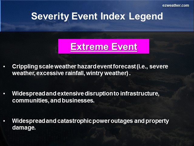
Severity Index
My brief thoughts for each period….
5 Day Period (Monday, August 24th through Friday, August 29th)
The very first item I want to discuss is the latest Tropical Storm Cristobal. The latest indications is that this system will not impact our county. Based on the 5pm advisory, the forecast track takes it away from the East Coast. By Wednesday, Cristobal will begin the process of moving rapidly out to see. The strength of this system will likely reach hurricane strength. The only impact will be felt along the Jersey shore where the surf will be up, but nothing major. I did put in a low threat confidence until this system clears our latitude, but again, based on all the model guidance, the latest trend is to move it away from our area. So, this is good news.
Now, in terms of the upper air pattern, what will keep Cristobal out to sea is upper level ridging that will develop over the Eastern US. While this ridging sets up, the weather will begin to feel more summer like as temperatures will begin to reach the upper 80s with some humidity. So, it will feel pretty warm and humid between Tuesday and Thursday. I going with a high confidence that will have a nuisance type heat wave, meaning it will be warm, but not extreme. For a more significant heat wave, temperatures would need to sore in to the 90s and heat index be around 100. Right now, not seeing that in the model guidance. If your outside doing work, take it easy and always drink plenty of fluids.
As far as any severe weather and flooding, I’m not forecasting any. With the ridge building over the East Coast, that will pretty much put a cap on things. Even with the ridging, there really isn’t a strong trigger to get our county bigger storms. So, I didn’t get into issuing any threat level. So, it should be quiet for severe weather.
6 to 10 Day Period (Saturday, August 30th through Wednesday, September 3rd)
This period will is looking more summer like. Just checking the European model run for today and it shows temperatures getting into the 90s for Saturday and Sunday. Even the GFS model shows that as well, but a bit cooler. The upper air pattern for this time frame shows that the 500mb trough will setup over the central US. It looks as though will be to the east of this feature. So, it does favor some above average temperatures and even above average precip. Any time your east of the trough, you can get severe weather and above average temps.
In the beginning of this period will likely have some excessive heat for the Labor Day weekend. I’m going with a high confidence for this period. At the same time, I have low confidence for severe weather and flooding. We will likely get some cold fronts to drop down in our area, but right now my confidence level on it is low at this time.
11 to 15 Day Period (Thursday,September 4th through Monday, September 8th)
This period will feature the trough still over the central US, but broader. Some of the model guidance favors above average temperatures and precipitation for this period. So, were going to see pulses of some excessive heat, more opportunity for cold fronts to move through our county, so the threat for some showers and thunderstorms look pretty good. So, I’m going with a medium confidence level for severe weather, flooding and even excessive heat. Right now, any tropical threat will be very low at this time.
So, thats pretty much it for the discussion this evening.
X
|
National Weather Service Mount Holly, NJ |
|
| Check out the Climate Prediction Center’s U.S Hazard Outlook by clicking here |
|
| Storm Prediction Center | |
| NWS Mount Holly NJ Facebook | |
| NWS Mount Holly, NJ Twitter |
*************************************************************************************************************************************************
Background
- I am very excited to provide a new forecast product for Camden County, New Jersey. In here will be a new experimental product that I’ve produced for the Philadelphia Area.
- Right now, I like to issue this product once a week, especially on Sundays. If time permits, I’ll issue a new forecast during the week.
- This forecast will aide Emergency Management, SKYWARN, and RACES for Camden County. The idea is to provide everyone with a forecast that gives them the needed lead time to prepare for hazardous weather that could impact the county.