
Good Evening Everyone,
A bit late getting this new forecast package out, but its now ready for everyone to check it out. As always with this experimental forecast product, due check back in the NWS official forecasts and outlooks on any future weather threats that could impact the county.
New table format below. Just click on the number, which corresponds to the PowerPoint slide number.
Weather Threat Assessment Forecast
Monday, June 30th through Monday, July 14th
Issued: Monday Evening, June 30th
.
Forecast |
Period Forecast |
Period Forecast |
||||
| Weather Threats | Weather Pattern | Weather Threats | Weather Pattern | Weather Threats | ||
| 1, 2, 3, 4 | 5 | 6 | 7 | 8 | ||
Note: Number indicates PowerPoint slide number
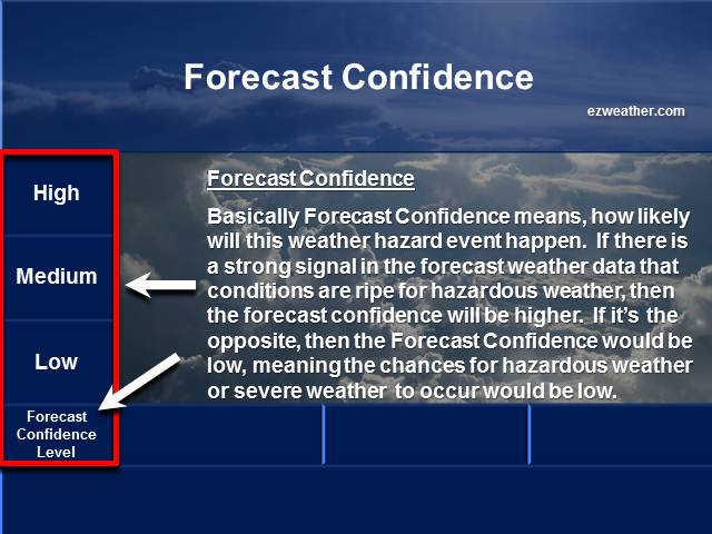
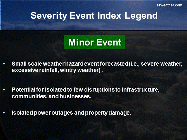
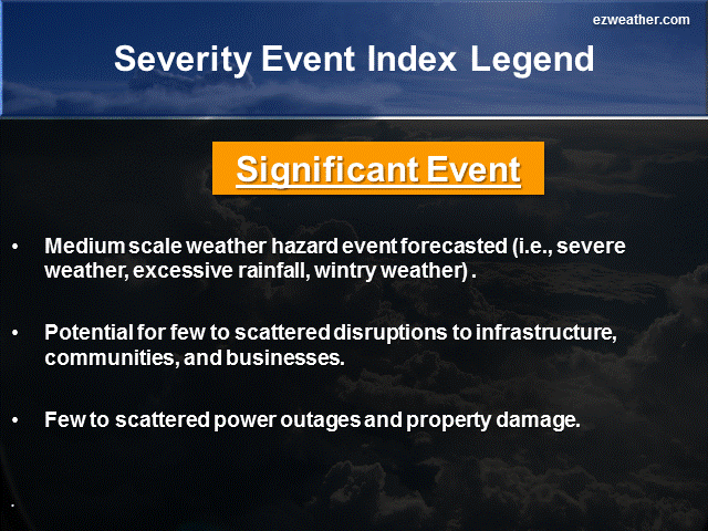
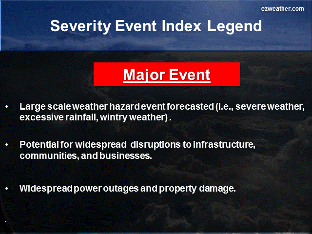
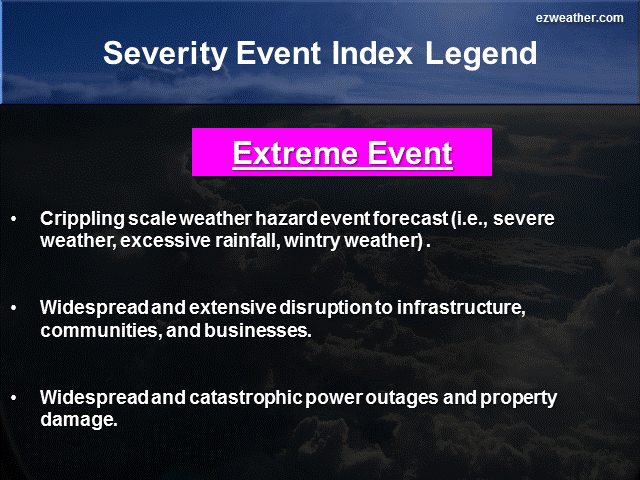
Below are thumbnails that further describe what Forecast Confidence and Severity Index are
Forecaster Confidence
Severity Index
My brief thoughts for each period….
5 Day Period (Monday, June 30th through Friday, July 4th)
This period favors several weather threats.
First, we have to contend with excessive heat. Temperatures on Tuesday will hit the low 90s with heat index values reaching the middle 90s. The worst of the heat arrives on Wednesday as highs reach near 95. With the high humidity levels, that heat index will be in the 100 degree range. Folks really need to take it easy the next two days.
Second, the severe weather threat. Significant trough thats impacting the Midwest tonight will gradually work its way down to our region on Thursday into Friday. This will be in the form of a cold front on Thursday. I think there is a good chance for severe weather, which means it could be significant and confidence level is medium. Given the heat and humidity and anytime you get a cold front ending the heat wave you really have to watch it. Thunderstorms will likely produce large hail and damaging winds. Now, the NWS in Mount Holly in their forecast discussion has mentioned that some of these storms on Thursday could be slow movers, meaning very heavy rain is possible. At least several inches worth. So, Thursday is a key day to watch for severe weather.
Third, a newly formed tropical depression just east of Florida will develop into the first tropical storm of the season, which would be Arthur. Right now, the evening model guidance shows the track paralleling the Southeast US Coast and then move well offshore and away from our area. Now, this system may interact with the cold front, meaning it could enhance thunderstorms, meaning tropical moisture. Overall, the tropical storm threat is low at this time.
6 to 10 Day Period (Saturday, July 5th through Wednesday, July 9th)
This period will begin cool as we take a break from the heat after this week. But, once we start getting into the following week, things will heat up big time. The upper air pattern moves the jet stream further to the north. Still, we have to watch some of the upper level disturbances, which could trigger storms. Since we will be to the north of this high, we have to watch for storms that may impact the Great Lakes region. I think there’s a good chance that we see some severe weather and it could be significant. I’m going with medium confidence on this one. Plus, the flood threat could be significant. Given the high heat and increasing humidity, we have to watch for these storms with high water content. Still, we have time to plan for this period. So, overall a hot and humid pattern with severe thunderstorms that could produce heavy rain, some large hail, damaging winds and isolated tornadoes.
11 to 15 Day Period (Thursday, July 10th through Monday, July 14th)
This period will continue to still feature a hot period with the threat of severe thunderstorms and excessive rainfall. The upper air pattern favors a summer type pattern. Right now, the pattern looks to be active. Temperatures will likely be much above average with precipitation being above average. Overall, I think severe weather, excessive rainfall, and excessive heat will be significant and my confidence level in this time frame is medium.
X
|
National Weather Service Mount Holly, NJ |
|
| Check out the Climate Prediction Center’s U.S Hazard Outlook by clicking here |
|
| Storm Prediction Center | |
| NWS Mount Holly NJ Facebook | |
| NWS Mount Holly, NJ Twitter |
*************************************************************************************************************************************************
Background
- I am very excited to provide a new forecast product for Camden County, New Jersey. In here will be a new experimental product that I’ve produced for the Philadelphia Area.
- Right now, I like to issue this product once a week, especially on Sundays. If time permits, I’ll issue a new forecast during the week.
- This forecast will aide Emergency Management, SKYWARN, and RACES for Camden County. The idea is to provide everyone with a forecast that gives them the needed lead time to prepare for hazardous weather that could impact the county.